This is a compilation of posts made on Instagram from October 21st to November 11th, 2020 documenting the successful completion of the 444 miles Susquehanna River thrupaddle carried out between September 21st and October 8th, 2020 (18 days).
If you’d like a more logistics focused account of the thrupaddle, you can check out our trip report preparations and daily logs.
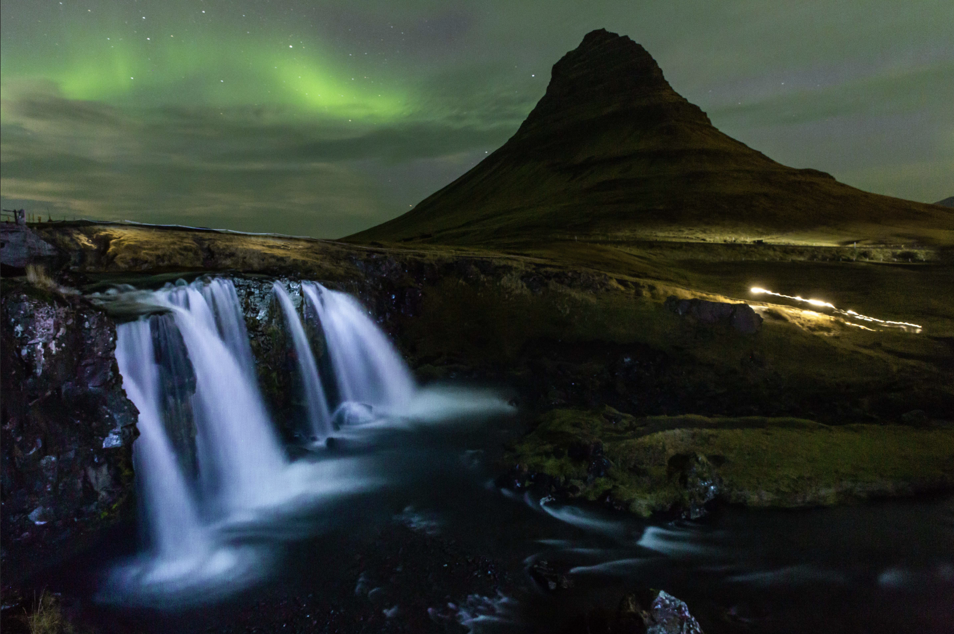
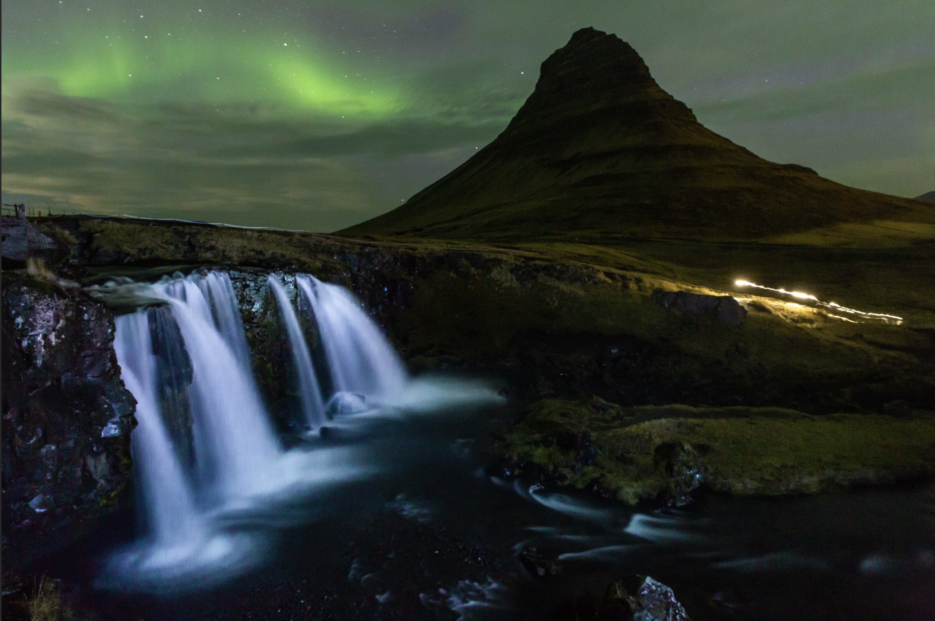
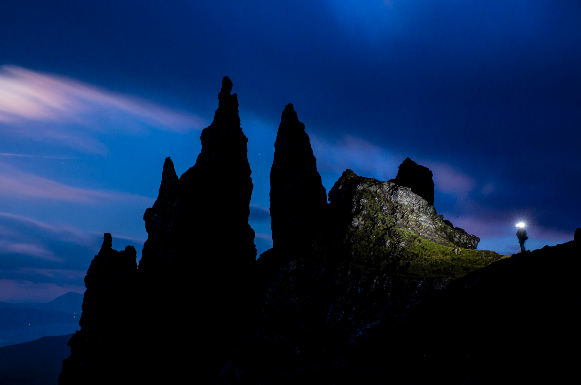
Intro
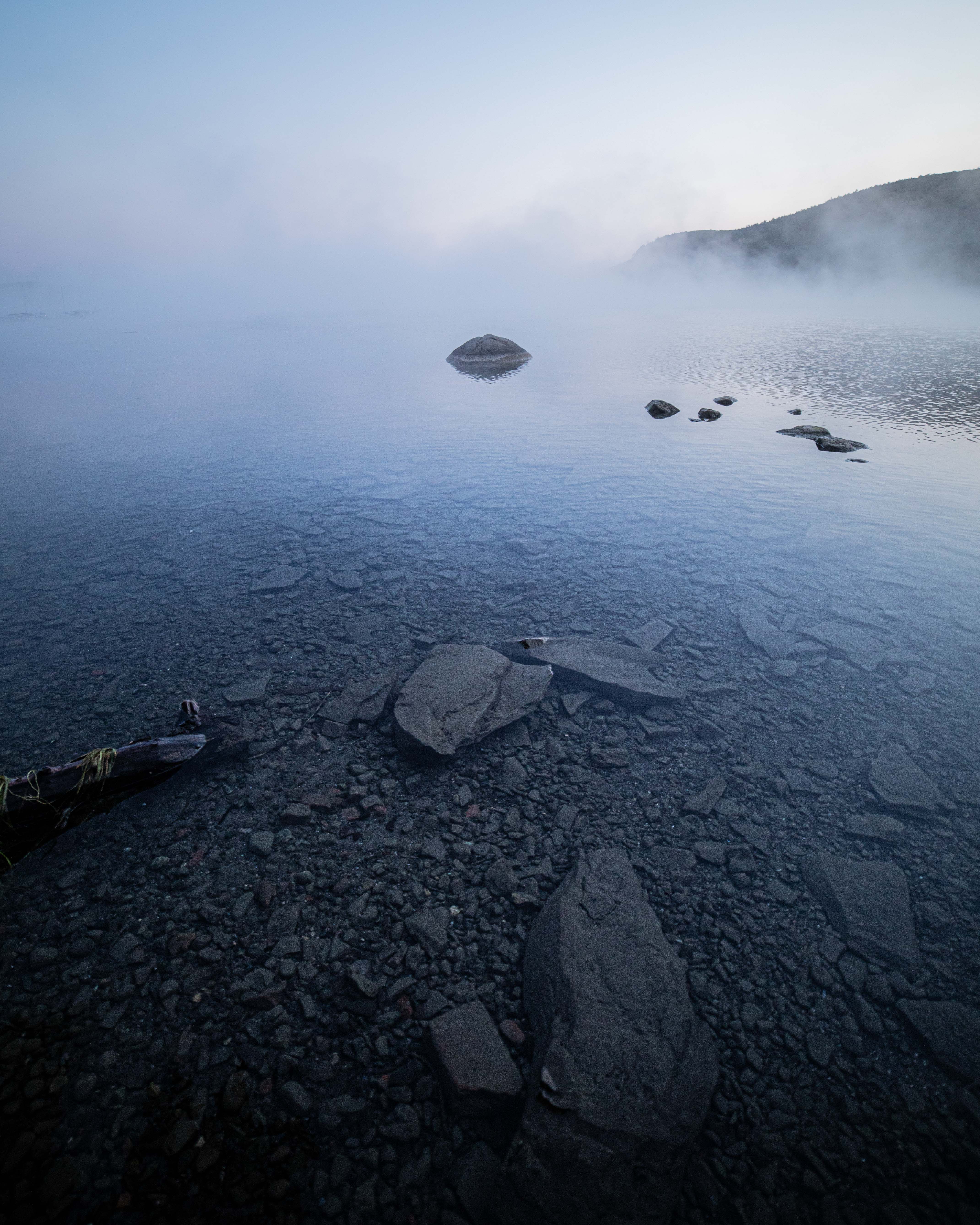
Photo: Joel Witwer
The Susquehanna River is the longest river on the east coast USA running 444 miles/715km from Lake Otsego in Cooperstown, NY to Havre de Grace, MD. The idea of kayaking the entire thing had been in the back of my mind since my college years as I’d drive along large chunks of it from my parents home near the river in Hershey, PA to college in Rochester, NY. With the pandemic all but shutting down my usual outlets of adventure, I figured now was the time to put the idea in the water and see how it floated.
I’ve long been an advocate that the best adventure equipment is the equipment you have available. And while I still believe this, I will say borrowing my parents recreational sit on top kayak was a little like attempting the Tour de France on a Walmart BMX. It was NOT my smartest move but (spoiler alert) I did finish the thru paddle and now may have been the first person to do it on a sit on top kayak.
With little to no convincing, I was able to recruit Zach Miller and Michelle Christiance to attempt the thru paddle with me. I know both of them from college and both had their own ties to the river. Zach grew up on the river in Columbia, PA and is now a professional runner who travels the world racing. While Michelle grew up on the river in Oneonta, NY and is now a photographer out in Denver, CO.
I did my research and read several trip reports of people who have thru paddled before. I figured we could probably do the 444 miles/715km in about 14 days based on what others had done. This gave us the goal of roughly 30miles/48km a day. I also read the river runs an average of 3mph/5kmph so I figured we’d have no problem. All of us have enjoyed the river before, but none of were more than novice kayakers.
As you’ll see, we had A LOT to learn.
Day 1
Cooperstown, NY – Goodyear Lake, NY
22 miles/35 km
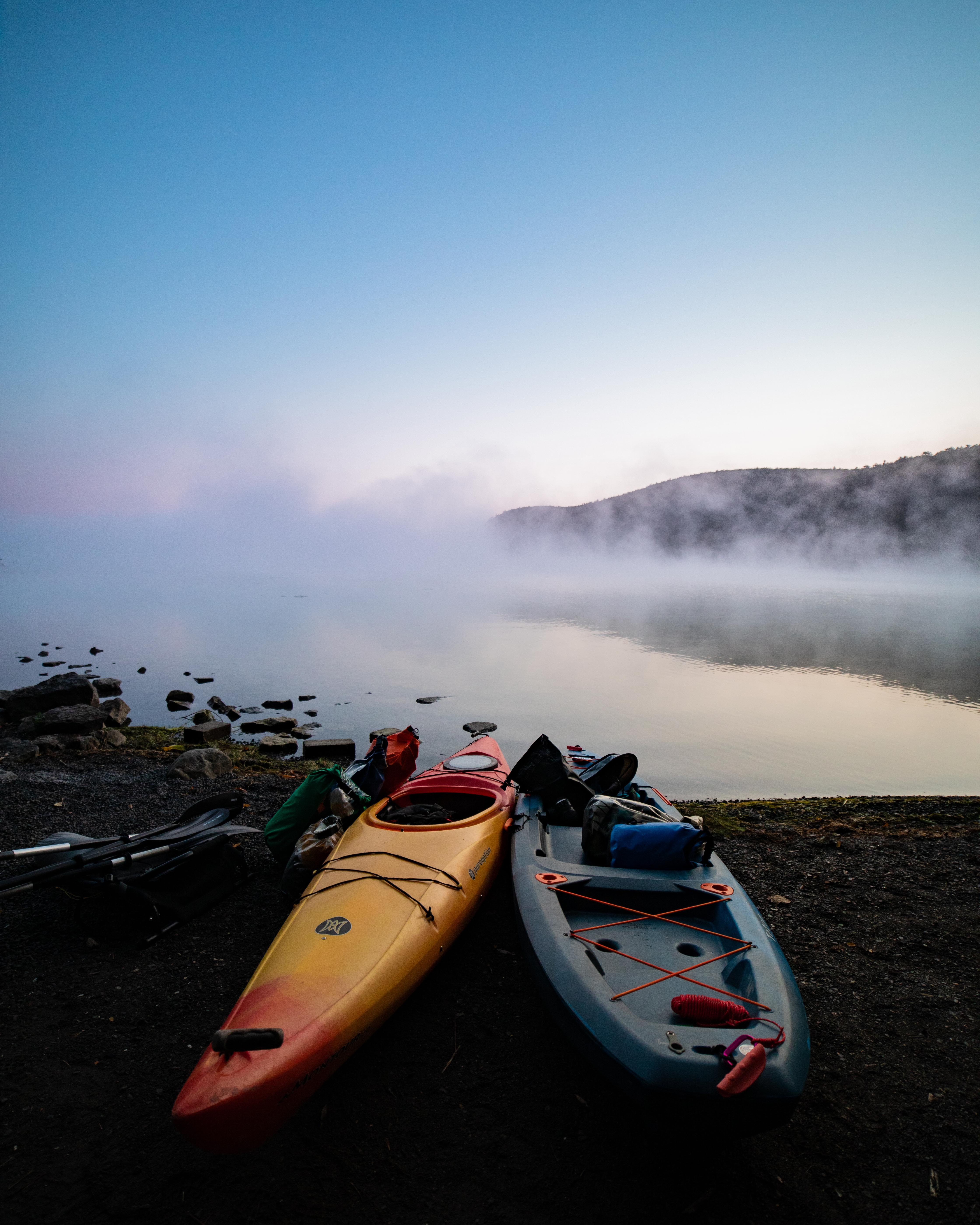
Photo: Joel Witwer
Day one was a cold and early day. Michelle‘s sister Kasey was joining Michelle, Zach and I for the first day of paddling. We had four kayaks to transport to the lake from Michelle’s parents house and a car only capable of holding two so we opted for two trips. Since we still wanted an early start, the first trip got Kasey and I there at around 6am then Zach and Michelle by 7. It was 30F/-1C outside and the breeze coming in off the lake made it feel even chillier. But the cold was made bearable by the stunning fog on the water that lit up as the sun rose. With all four of us there, we set off in high spirits.
Within half a mile, we hit our first dam portage which was supposed to be our first of three that day. In my planning, I wasn’t sure how to measure river miles and with no good river trail maps for the NY section of the Susquehanna, I measured distance by tracing roads that ran roughly parallel to the river. 30 miles/48km for the day had us roughly ending in Owego, NY. Turns out, rivers don’t run as straight as roads so even though we were getting our miles in, we weren’t making near as much southerly process as I had anticipated.
Otherwise though, we were having a great time. I had always known the Susquehanna as this mile wide behemoth of a river so it was fascinating to experience it as this relatively small stream.
At 3pm, Michelle’s mom met us for a late lunch and it was after that serious doubts began to rise in my mind. It was obvious I had overshot how far we could make it in a day but we were still about 9miles/15km out from Collier Dam which I had foolishly anticipated would be our halfway point for the day. It was 7pm and getting dark before we called it for the day at the north end of Goodyear Lake (Collier Dam is at the south end of the lake). We made it 22miles/35km which wasn’t that far behind the daily mileage goal, but less than half the as-the-crow-flies distance we had expected to cover. It was disappointing, but we were exhausted and thankfully Michelle’s family was providing us hot dinners and warm beds.
Day 2
Goodyear Lake, NY – Wells Bridge, NY
22 miles/35 km
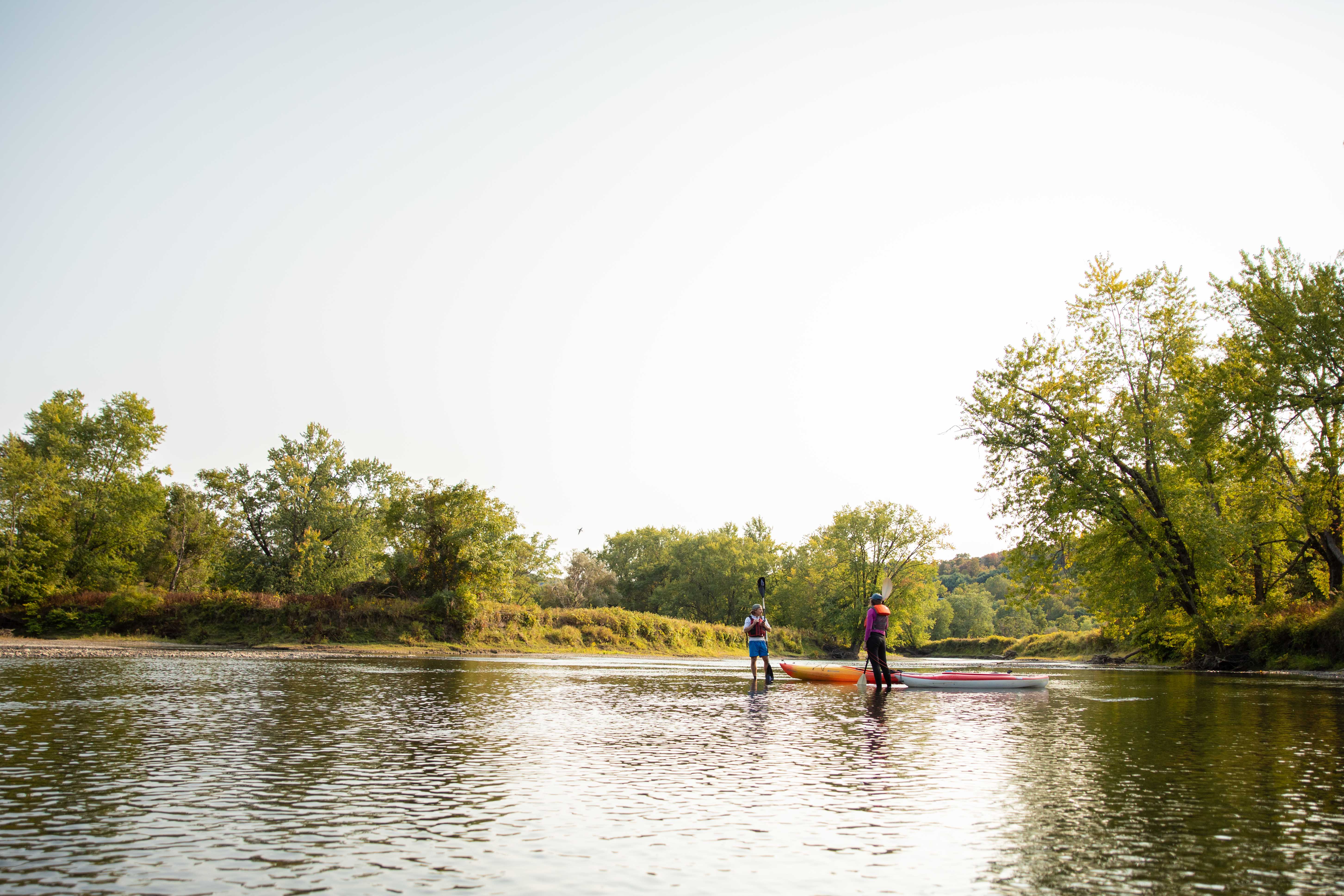
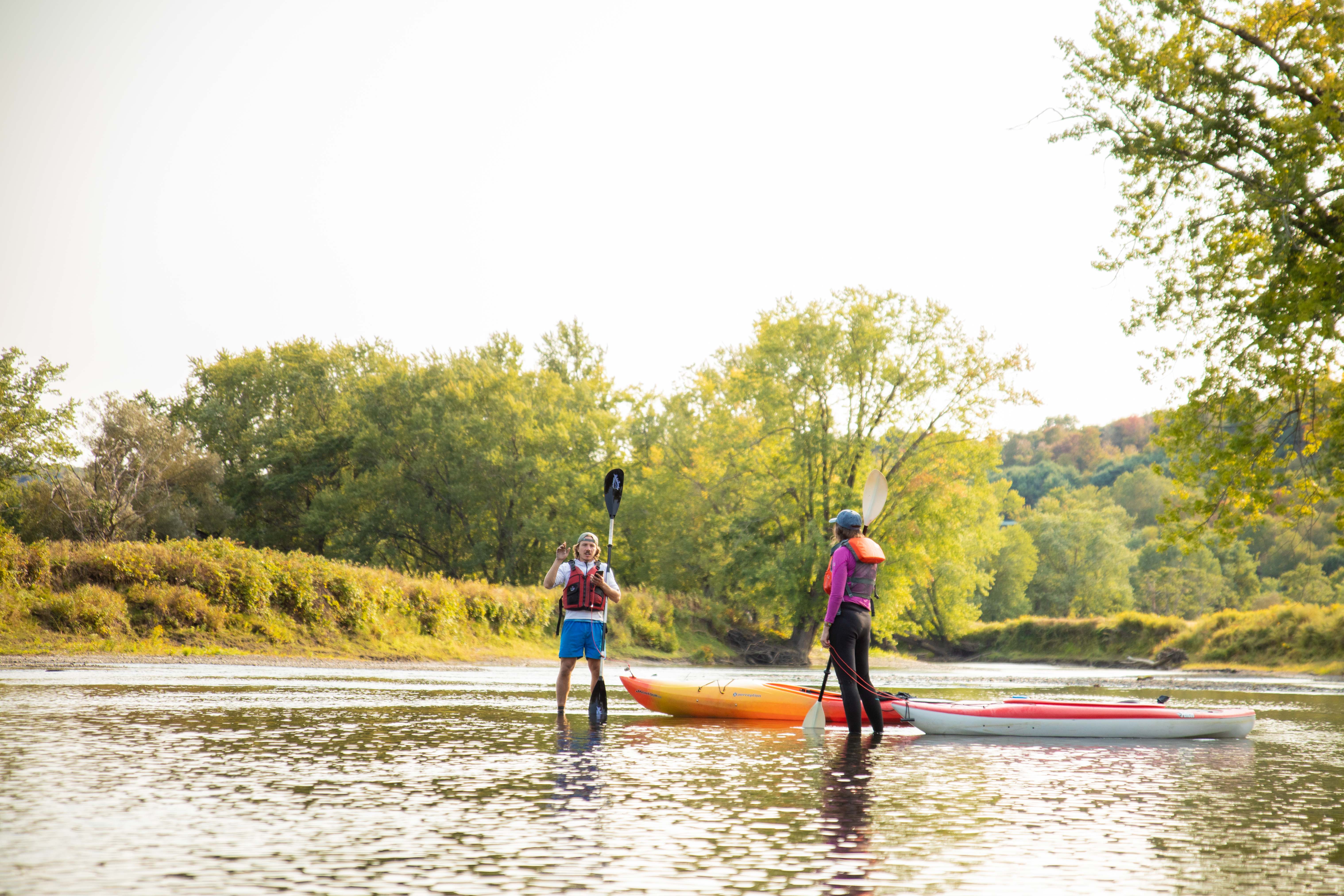
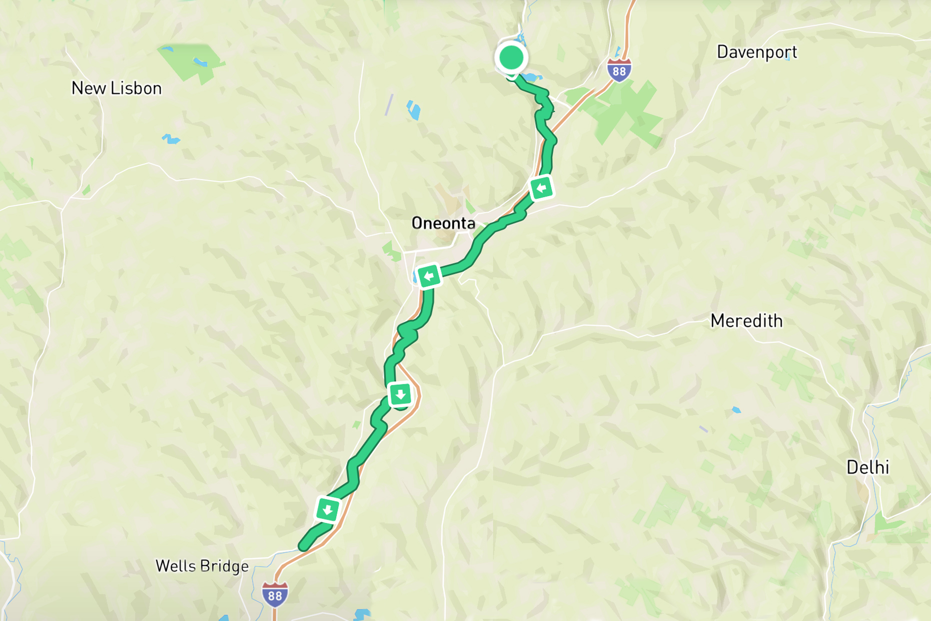
Photo: Joel Witwer
Day two started out in a dense fog as we crossed Goodyear Lake. Dense like if someone else got more than 50ft/15m away from you, you couldn’t see them. We hugged the shore and made our way towards Collier Dam which held up the entire lake. The fog broke just about as we got to the dam and we had to portage our three kayaks up a steep hill and down around the dam.
While we had been blessed with deep water from the dam backlog, after the dam we were in some of the shallowest water of the entire trip. It felt like we were puddle jumping. Paddle 100ft then hit a rock bar, get out, pull the kayak across the shallows, paddle through the next deep water section, then hit the next rock bar and repeat. Turns out all the accounts I had read of people attempting the river had been done in spring or early summer when water levels are high and healthy. The river at the beginning of autumn is low and slow. To make matters worse, it had been a drought year with people telling us they’ve never seen the river this low before. At times, it felt like we were doing more walking than paddling. It’s still a strange image to me (like the photos above) for us to be standing in the middle of a river, but only ankle deep.
In a particularly windy and shallow section I was exasperated and claimed “Next time we do a trip like this, we’re paddling a canal – straight and deep.” Zach just kind of chuckled and responded in his ever optimistic wisdom “But it’s kind of like life, you know? It’s never straight forward and the depth is always varying. You just gotta keep moving forward.” There’s a lot of truth in that but I still wished I was on a canal at that moment.
Mama Christiance (Michelle’s mom) once again met us for lunch and gave us the encouragement we needed to push on.
In the afternoon, we made it over our third dam of the trip in downtown Oneonta and then is was smooth (albeit still shallow) sailing. We passed Otego (day one’s initial end goal) around 5pm and made it just north of Wells Bridge, NY by the time it was about to get dark. Another 22 mile day.
Day 3
Wells Bridge, NY – Middle Bridge, NY
21 miles/34 km
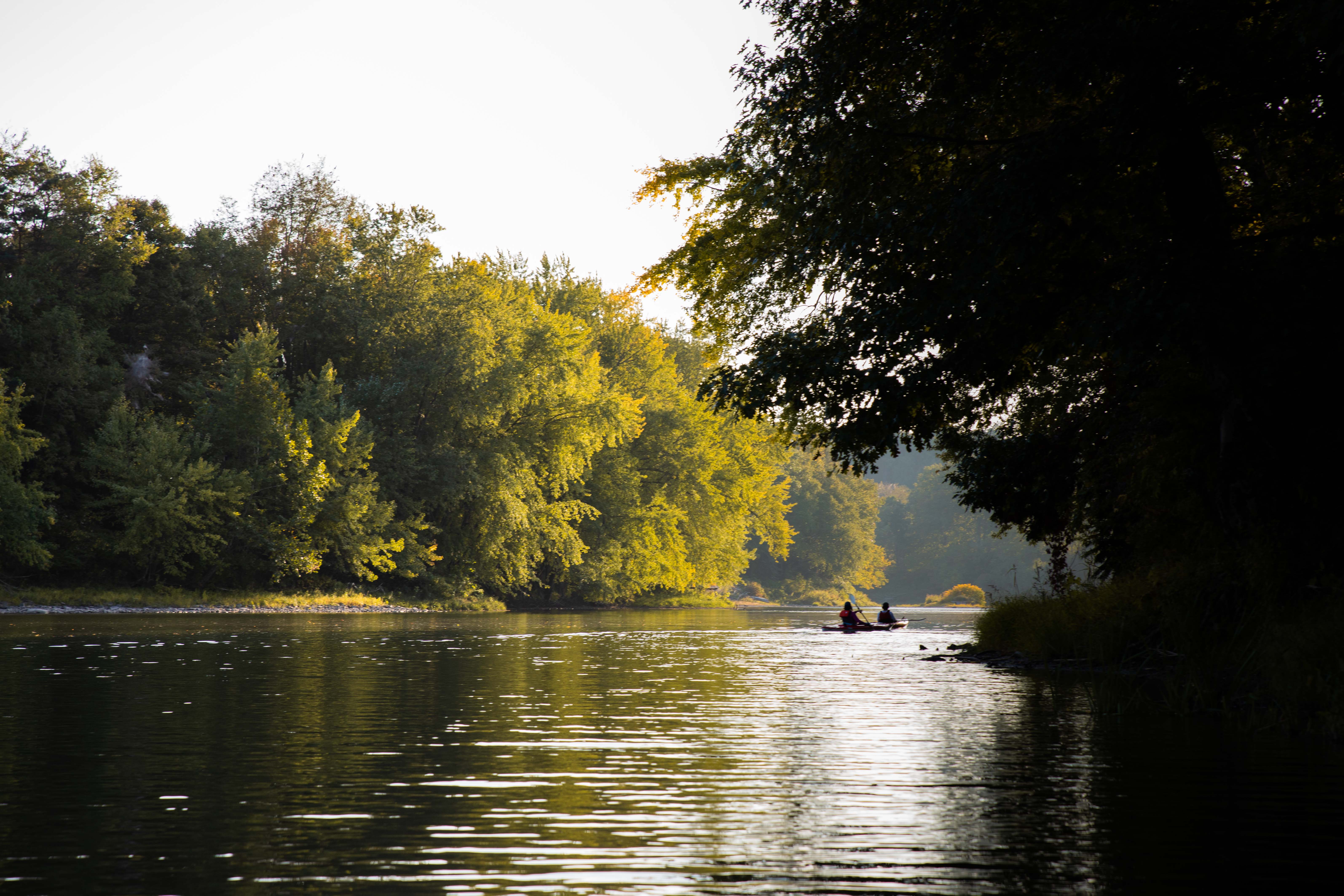
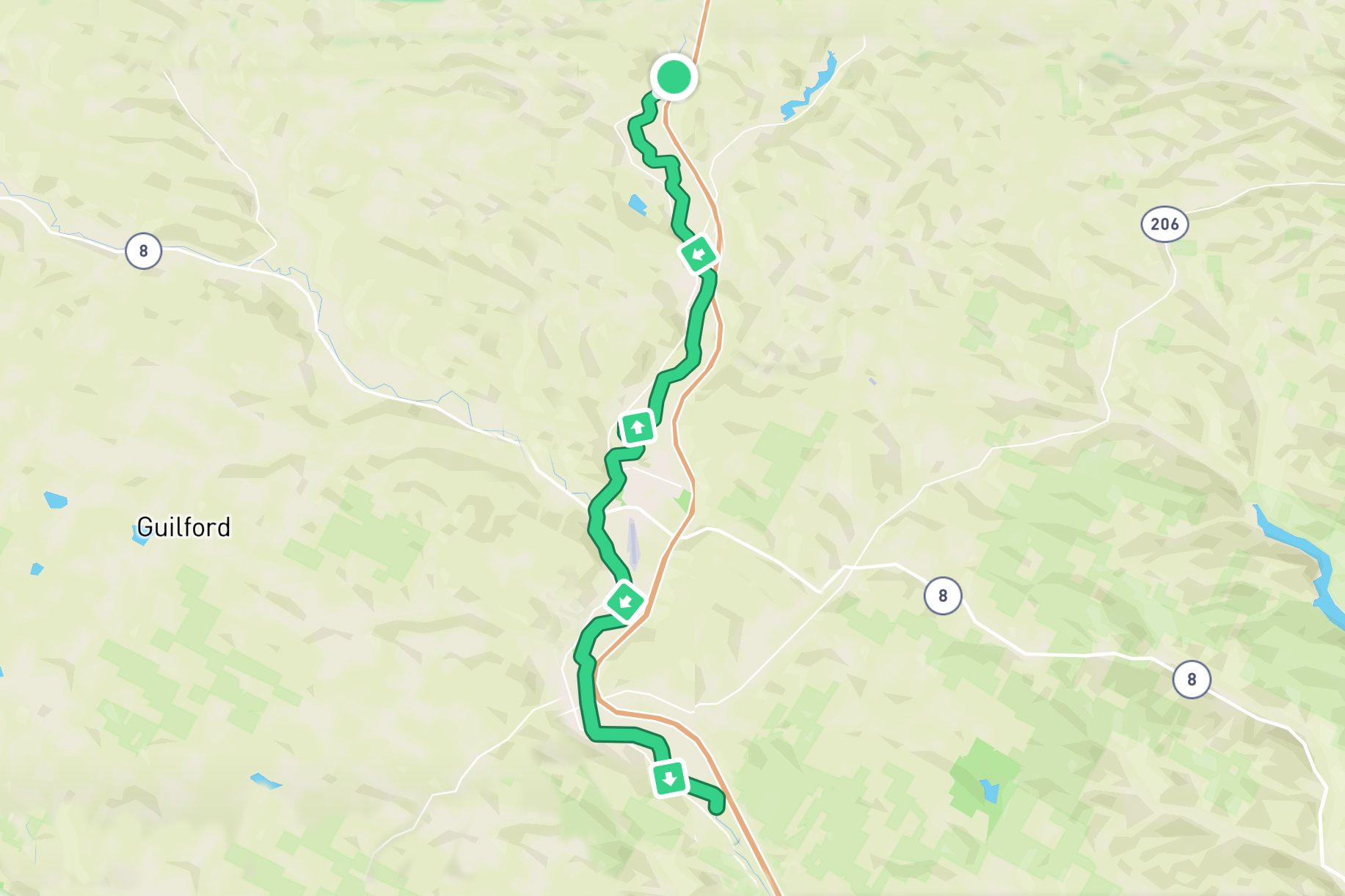
Photo: Joel Witwer
By day three, we were beginning to settle into a rhythm. The mornings were cold and we were rested so we paddled fast. We did so partly to start the day off right, but mostly get warm. The evening sun burnt hot so we tended to slow down as the day went. We also gravitated towards a 2-1 paddle pattern with two people paddling together while the other paddled either ahead or behind. The pairings rotated between us all, but with both Michelle and Zach being on the more verbal and fast paddling end of the spectrums, they paddled together a good amount of the time allowing me the space to paddle and think, an opportunity I cherished.
We also naturally established a coal-canary type system for dealing with the frequent shallow rapids. The first person would visually assess the rapids and guess the best way through. If they made it, the next people would follow. If they ran aground and got stuck, the followers would attempt a different route. It wasn’t a perfect system, but by the first person’s warning, just like the coal canary’s warning in the mines, the followers were able to adjust their course and have a better chance of success.
We stopped for lunch in Sidney, NY and we were once again met by Mama Christiance who provided us with delicious chicken sandwiches. But this was the southern end of her range and after this we were truly on our own.
After lunch, we paddled about ten more miles until ending early (5.30pm) in Middle Bridge, NY. Since this would be our first night wild camping, we ended well before sunset (6.30pm) at my request so we could find a place to camp and establish what our camping system. The first island we checked had a house on it which was a no-go for us, but a smaller, nearby island was completely empty and provided the perfect camping spot. We pulled our kayaks onto shore, hid them in the weeds, set up camp, and I was asleep almost instantly – something which would become a reoccurring theme on this trip.
Day 4
Middle Bridge, NY – NY/PA Border
30 miles / 48km
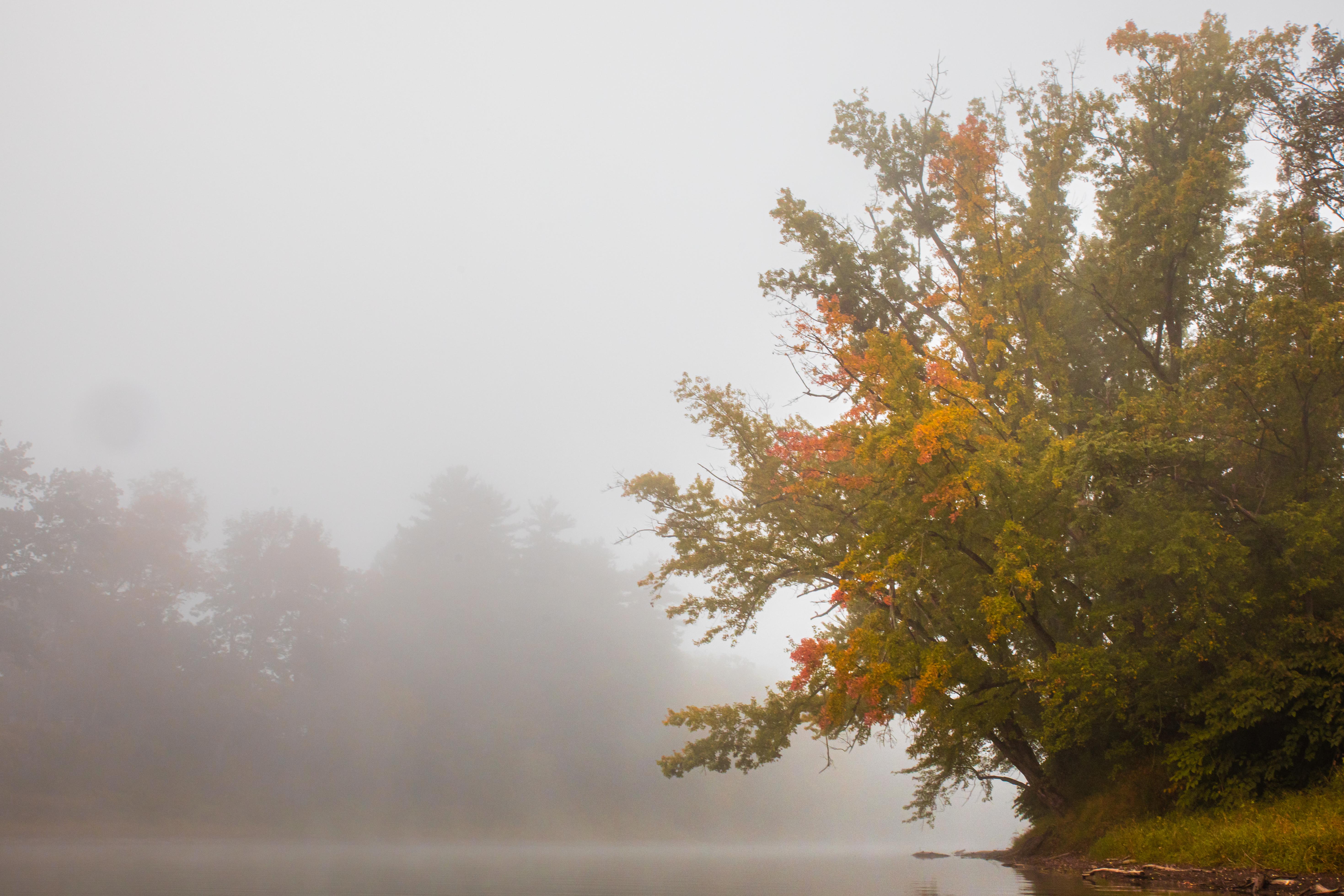
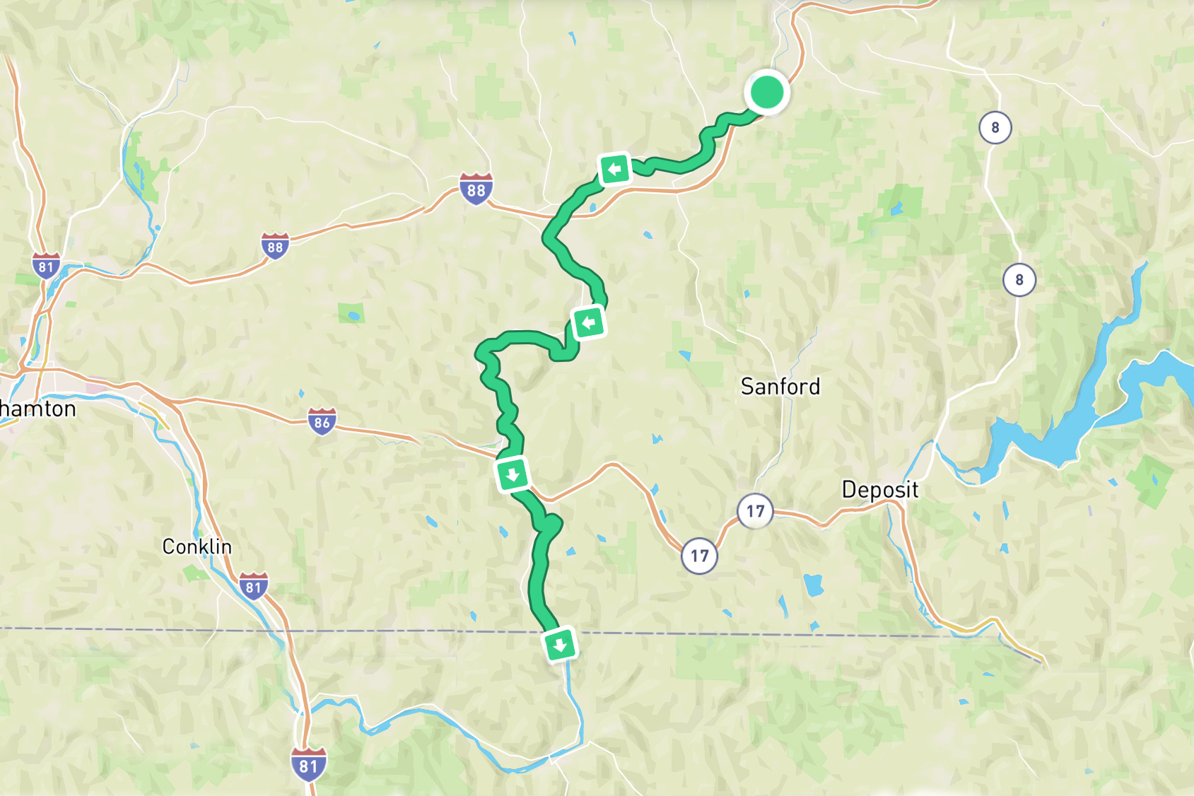
Photo: Joel Witwer
Every worthwhile adventure has a point where you begin to wonder if it’s all worth it. A low point where every movement forward just seems to make things worse and the sweet relief of quitting is constantly flirting with you. For me, this happened on day four of our thrupaddle.
It started out just like any other day. We packed up the campsite, pulled the kayaks out of their hiding spot, and set out on the river shrouded in beautiful morning fog. There was a level of physical exhaustion that shadowed us this whole trip, but on day four I was battling an emotional exhaustion which is far harder to fight through (at least for me). There were a few times I almost told Zach and Michelle I couldn’t (more realistically didn’t want to) go any further, but the shame I associate with quitting for no other reason than it being hard kept me paddling, one dip after another. I then fantasized about “accidents” I could have which would justify me leaving the river like if I capsized just right as I paddled through a semi-submerged tree, I could probably break my arm and no one would fault me for leaving the river with a broken arm.
As I analyzed why I was emotionally struggling so much, I narrowed in on two things:
1. I wasn’t convinced we’d actually finish the river. We were behind schedule and seemingly falling further behind every day. If we had no shot of reaching the goal, what was the point of battling through every paddle?
2. It had become evident that out of three of us, I was the weakest paddler. Zach and Michelle were incredible in never making me feel like a burden, but a large part of my identity is wrapped up in my strength so to be the one holding up the group stung my ego. Additionally, the whole trip had been my idea, but I felt to be the one struggling the most.
There was no romantic resolution to my day four struggles. Somehow I just kept putting one paddle in after another and we made it to the PA/NY border as the sun was setting meaning day four was our first 30mile/48km day. Two certain victories for sure, but I was just happy to be done with the day.
Day 5
NY/PA Border – Binghamton, NY
25 miles/40 km
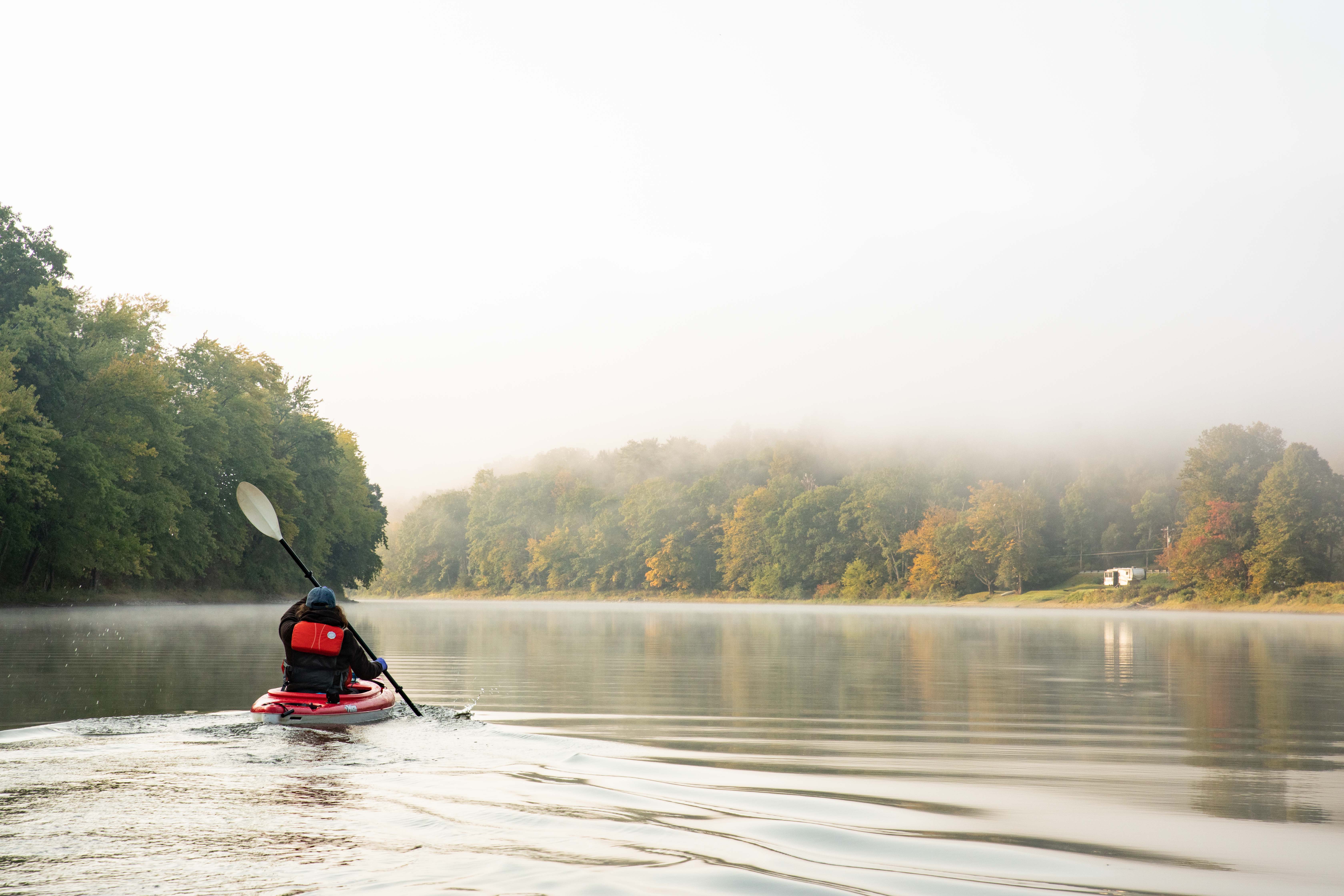
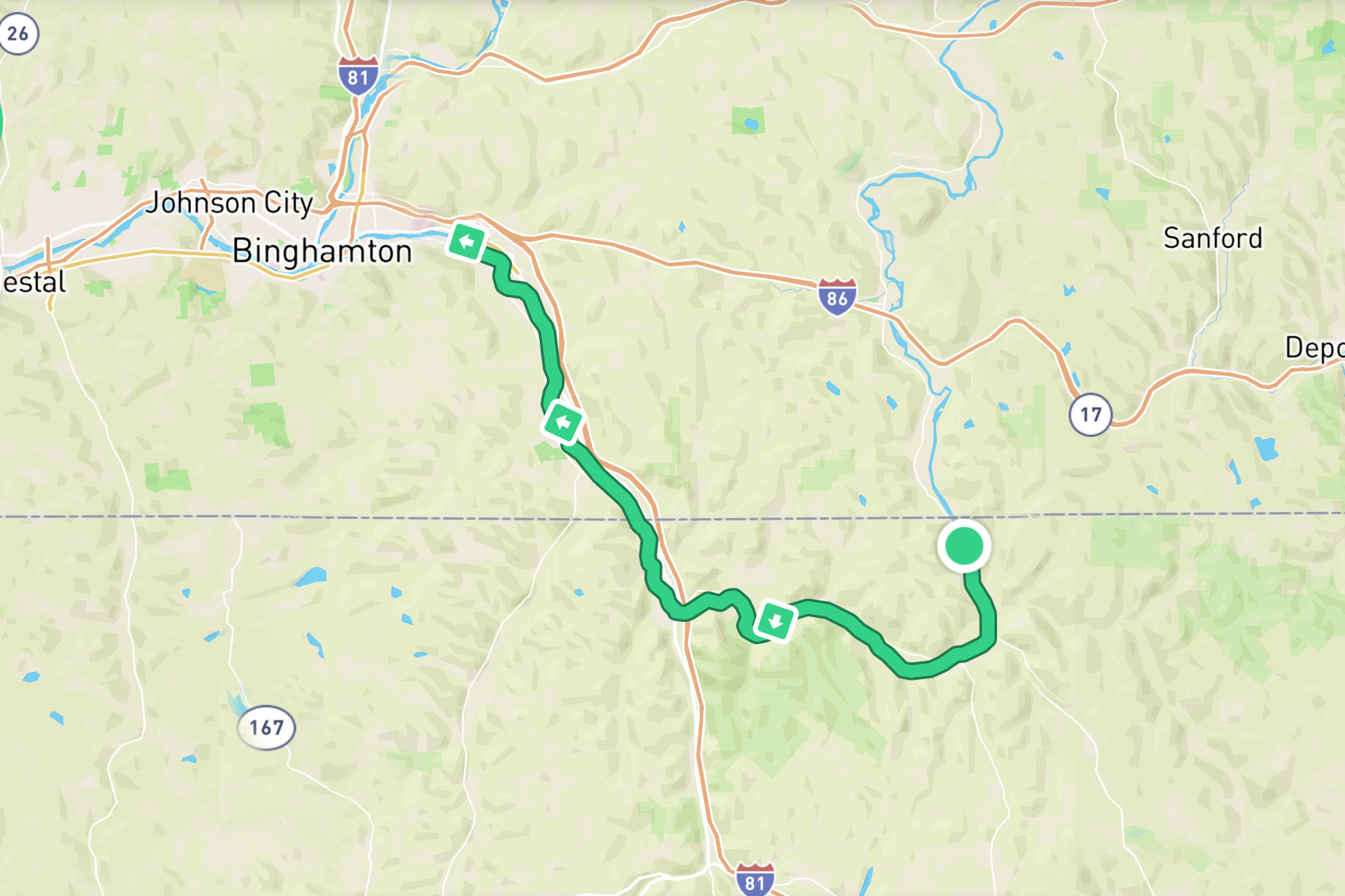
Photo: Joel Witwer
A good night’s rest coupled with the previous day’s morale victories of both paddling a 30mile/48km day and making it into PA (although we’d soon re-enter NY) had me back on the kayaks with Zach and Michelle as the fog slowly burned off the river. After our bodies had warmed up, we stopped for another dam portage and breakfast in Susquehanna Depot, PA. We realized that we were running low on supplies and would need to restock pretty soon. One joy with this trip is while it felt secluded and wild, we were never more than an hour or two from small (and a few big) riverside towns.
By lunch, we had paddled into Great Bend, PA. We pulled the kayaks up under the bridge and called a nearby pizza joint. Since the shop didn’t deliver under the bridge, I went to pick up some groceries as well as the pizza while Zach was tasked with finding a place he could get a little charge in our phone power banks. Meanwhile, Michell stayed back to keep an eye on the kayaks.
The food run went off without a hitch although it felt sketchy to be walking along the road laden with a pizza box and bags of groceries then to disappear into the high weeds and down to the river.
Regardless of the actually quality of the pizza, it tasted like the best lunch I had ever had. Then with that and a plethora of my newly acquired protein bars, trail mix, and snacks, I was ready to hit the water again.
I felt great paddling all afternoon and yesterday’s struggles seemed long past. In retrospect, my mental struggles were most likely at least partially caused by not eating enough. There was only so much we could carry on our kayaks and we were learning that we’d need to take these resupply breaks a little more often.
By sunset we had reached the eastern edge of Binghamton, NY and found a secluded island to camp on. Zach found us an unconventional campsite nestled in the river weeds. It was hidden from the river and had three offshoots – one for each of us. When you lay down, the cathedral of leaves rose above you and you could faintly make out the moon above. I fell asleep that night full, warm, and happy.
Day 6
Binghamton, NY – Owego, NY
25 miles/40 km
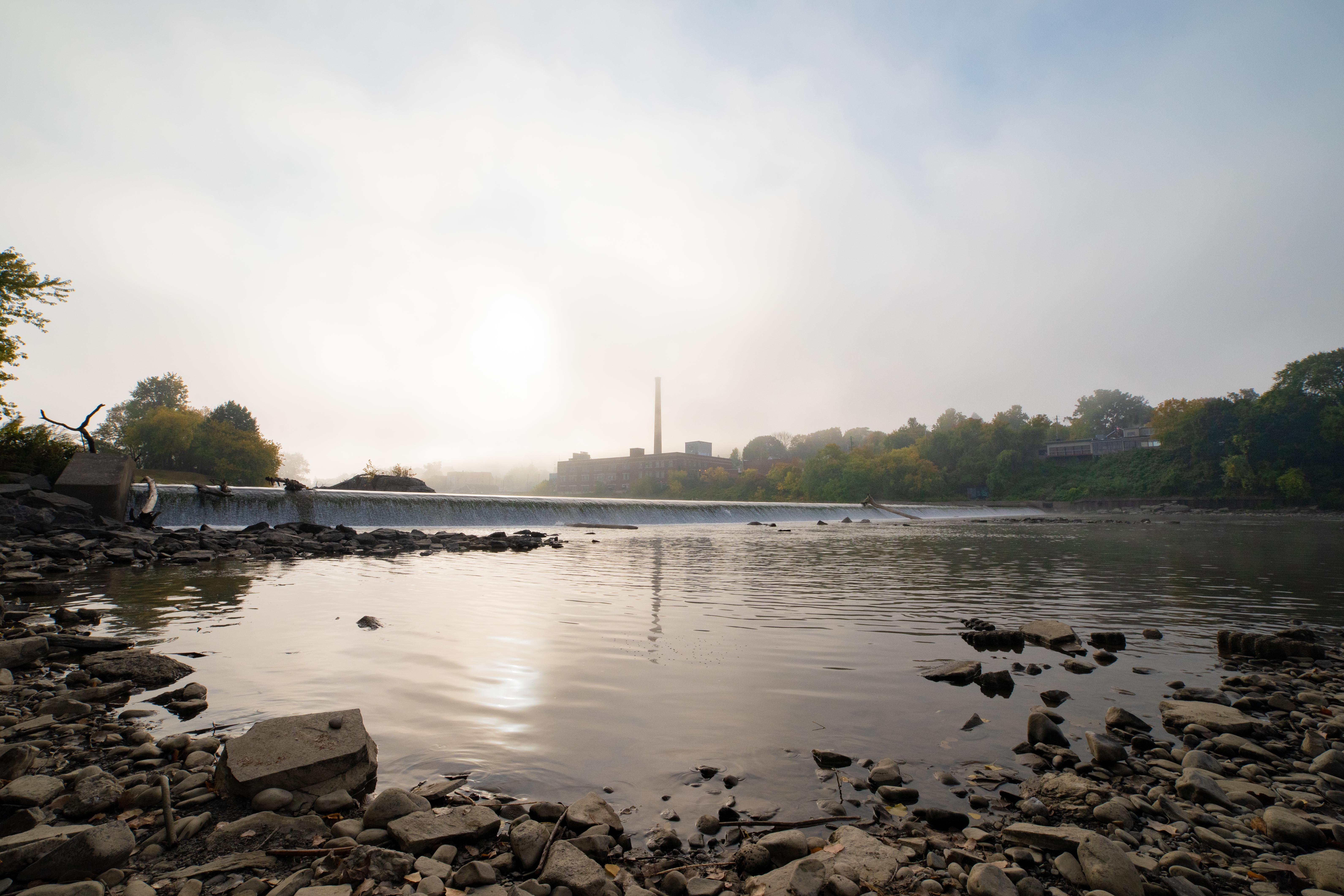
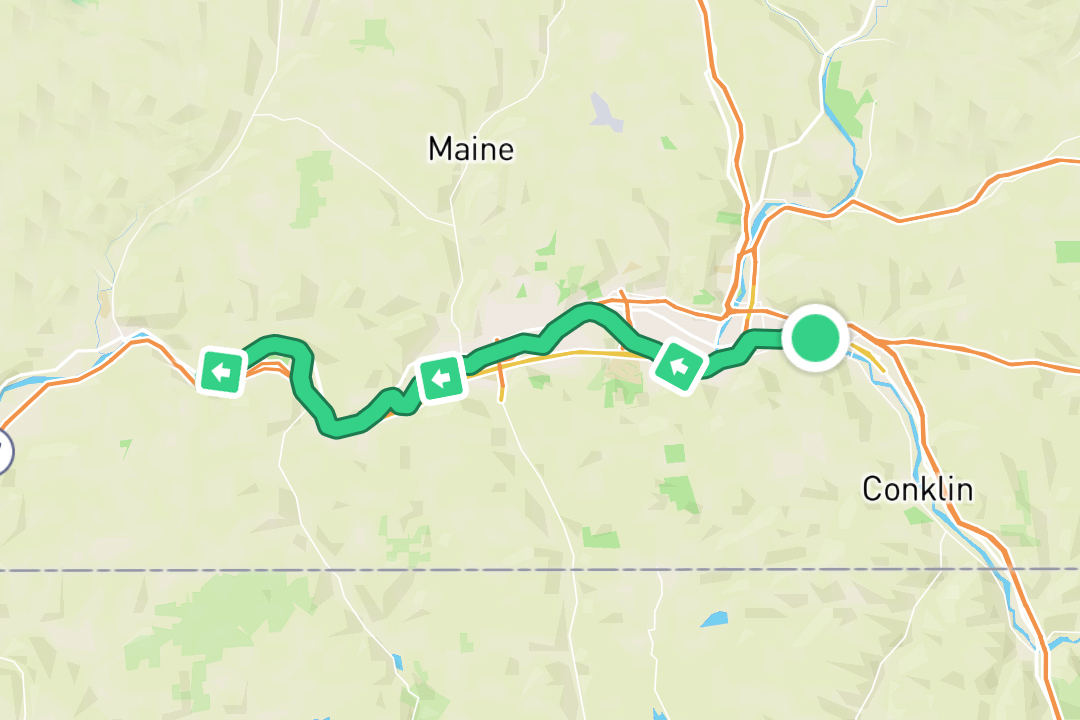
Photo: Joel Witwer
The morning started out with what I’ve come to call “thick water” – currentless water which provides absolutely no assistance as you paddle. The current varies wildly over the course of a river, but the water always gets thick a few miles upstream from a dam and day six had two dams.
The first dam was right in Binghamton and we had repeatedly been warned about it. Since Zach, Michelle, and I have all lived along the river, all our families were playing big roles in supporting us as we passed by. At the beginning of the trip, we created a group chat we lovingly referred to as the “moms text.” The purpose being to share photos and keep our families included and updated on our adventure. The moms in turn kept us entertained with their texting mom antics and advice they were reading on the internet.
A few of our moms had read some horror stories of people get injured accidentally kayaking over this first dam of the day and had expressed their worries for our safety. We had of course done our research and knew where the dam was and how to get around it safely. In reality, this dam was quite inconsequential and well marked compared to some of the dams we navigated, but the internet loves to share worst case scenarios and get people all worked up.
To be fair though, it has to be hard as a parent to have that voice in the back of your mind saying “this is my child and I have to look out for them” but also realize your child is now a fully functioning adult. At some point, you just have to trust you’ve raised them right and prepared them for the world. I think all our moms in the “moms text” have done a pretty stellar job of this. But we still gave them the “all clear” when we had safely passed the dam and they gave a digital sigh of relief.
From there on, day six was rather uneventful. Three more portages around one more dam and two pipelines crossing the river.
We ended the day just outside Owego, NY and realized there was a Panda Wok take out near our chosen island. So we might’ve been “roughing it” but we ended day six with some solid Americanized Chinese food in the campsite.
Day 7
Owego, NY – Ulster, PA
30 miles/48km
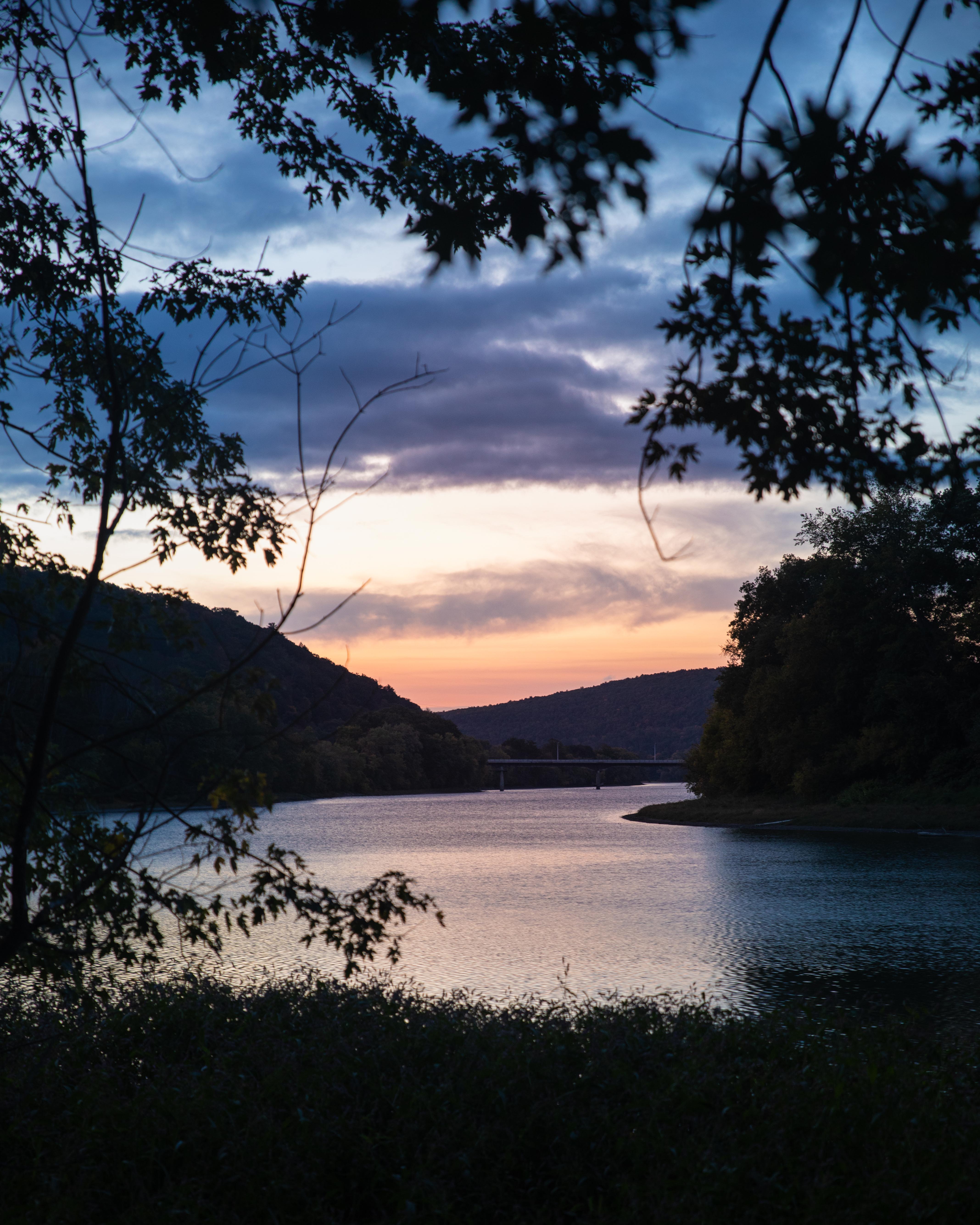
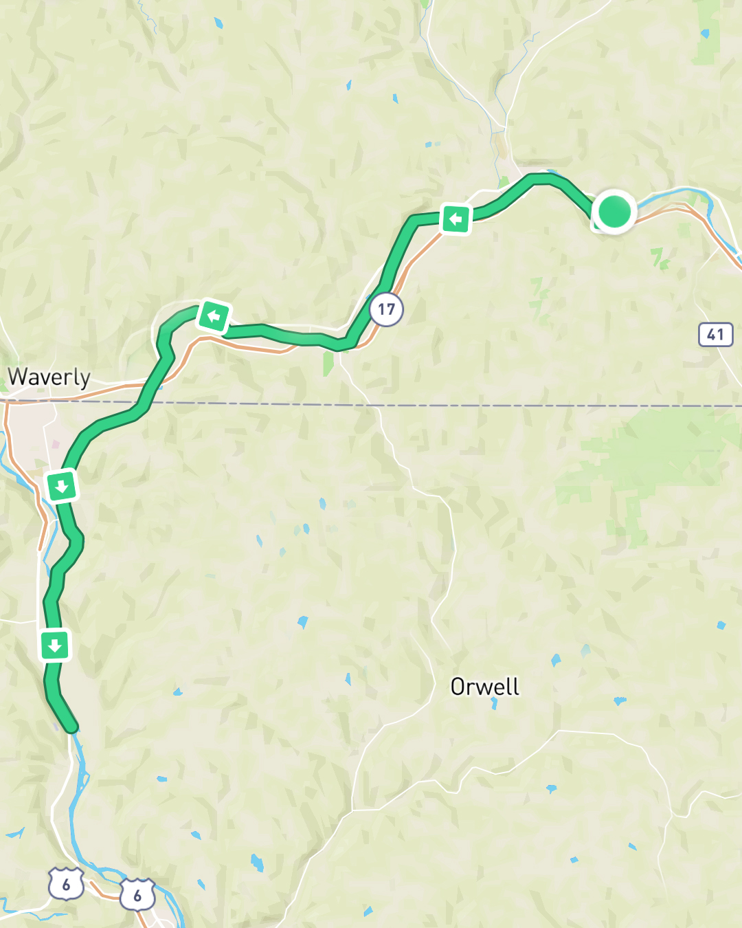
Photo: Joel Witwer
The first half of the day from Owego, NY to the NY/PA border (again) was rather uneventful. Right after we hit the border though, it was like a switch was flipped and we were hit with a massive headwind. The sun was high and hot so the breeze was refreshing at first. But as it picked up, it seemed to almost reverse the current. We could’ve sworn we were paddling upstream. To make matters worse, the wind conjured these waves going against us that actually had whitecaps breaking against our kayaks, soaking us, and trying to push us backwards. During particularly strong gusts, little ripple waves would form on the actual waves and I’m not sure they slowed us down any further, but they were infuriating.
While I hated this stretch of the river from the NY/PA border to Athens, PA, a sick part of me kind of liked it. For the first time on the trip, I felt like I had a battle to fight. Sure I fought fatigue and the desire to give up every day, but those are long drawn out wars that wouldn’t be won until we finished the river. But here, the wind and the waves presented an immediate adversary to overcome. I could paddle slowly and strongly and refuse to give in. I could outlast them and overcome them. Having an adversary and a battle gave me purpose on day seven and got me through. But with this said, it’s easy to fight a single battle.
There’s a reason warriors get glorified and not battliors. A warrior fights battle after battle, day after day. For me, it’s easy to get overwhelmed by all the battles that lay between myself and the end of whatever my war is. All I can do is give my all to the battle I’m in and then focus on the next battle as it comes. This gets done again and again until the war is won. This is exactly what I needed if I was going to finish the river. The Susquehanna is too big for me, but I could beat this headwind. Then I can handle those rapids. And then I can work my way through those shallows. I learned I needed to break the long war down into its individual battles and focus on fighting each of those ferociously on my way to the final destination.
Day 8
Ulster, PA – Wyalusing, PA
30 miles/48 km
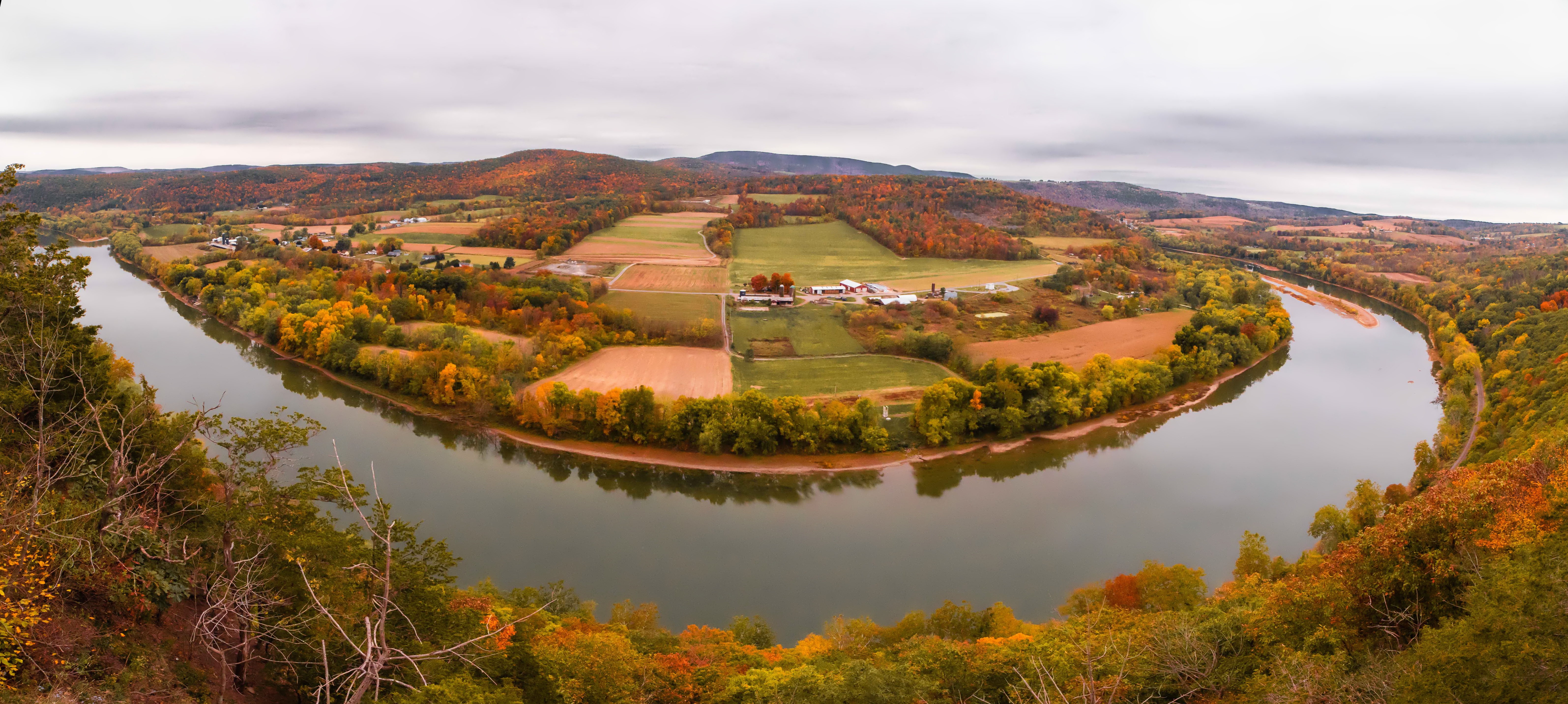
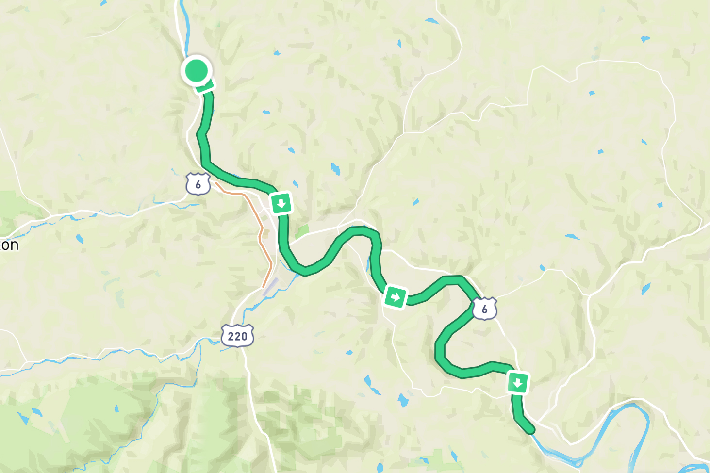
Photo: Joel Witwer
Day eight started with a fasted and brisk morning paddle. After about six miles, we pulled over at a public campsite which gave us the space eat our protein bars and river mix at an actual picnic table, charge our phones at an outdoor outlet, and fill our water bottles without having to slowly pump the water through a water filter. At this point, it was the little things that brought joy.
We were soon back on the water and settled into a steady paddle. As we went, Michelle mused “Do you ever think how we might be the only people paying this close attention to how the leaves are changing color?” I responded with a gruff and grunted “probably.” I was over here thinking about how my whole body hurt and she was over there thinking about that sort of thing. That’s just the person Michelle is – seeing and focusing on the beauty in and around every situation.
As the day went on, her musing stuck with me and she was right. We probably were. When we started in Cooperstown, NY over a week and 175 miles ago, the leaves were all green in every direction. As the day and miles went by, we started to notice a few leaves turning golden, then maybe a branch or two. Soon we’d find a whole tree highlighted with stunning yellows, oranges, and reds. And at the current point in the trip, it wasn’t uncommon to find ourselves embraced in the warm colors of autumn on all sides. We had been, and still were, surrounded by these trees all day every day and we were blessed with the opportunity to witness their slow transformation day by day, hour by hour, and paddle by paddle. In years past, I had just woken up one day and been like “oh cool, the leaves are yellow now” but Michelle was right, this thrupaddle had gifted us this intimate experience to transform alongside nature.
Day 9
Wyalusing, PA – Tunkhannock, PA
25 miles/40 km
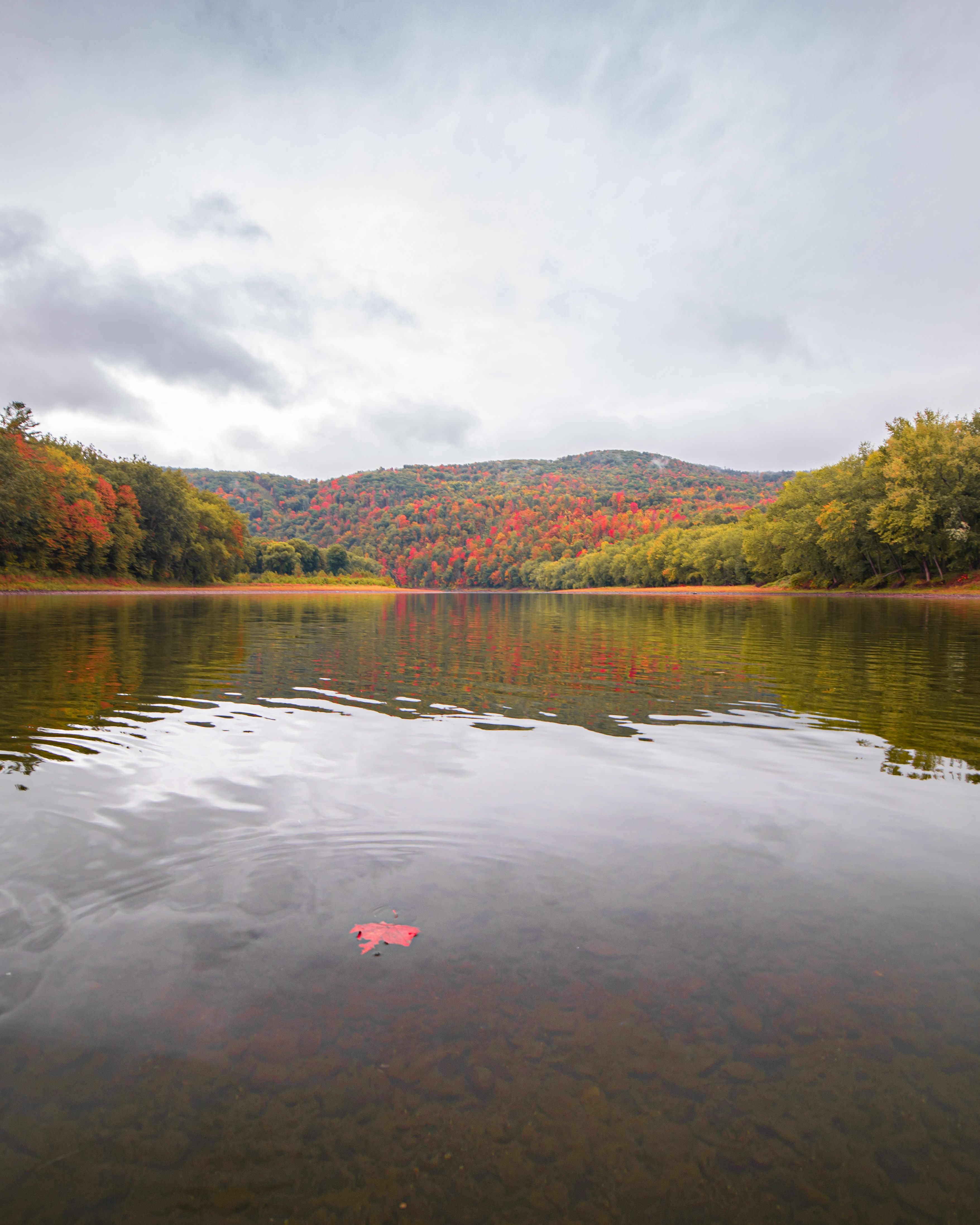
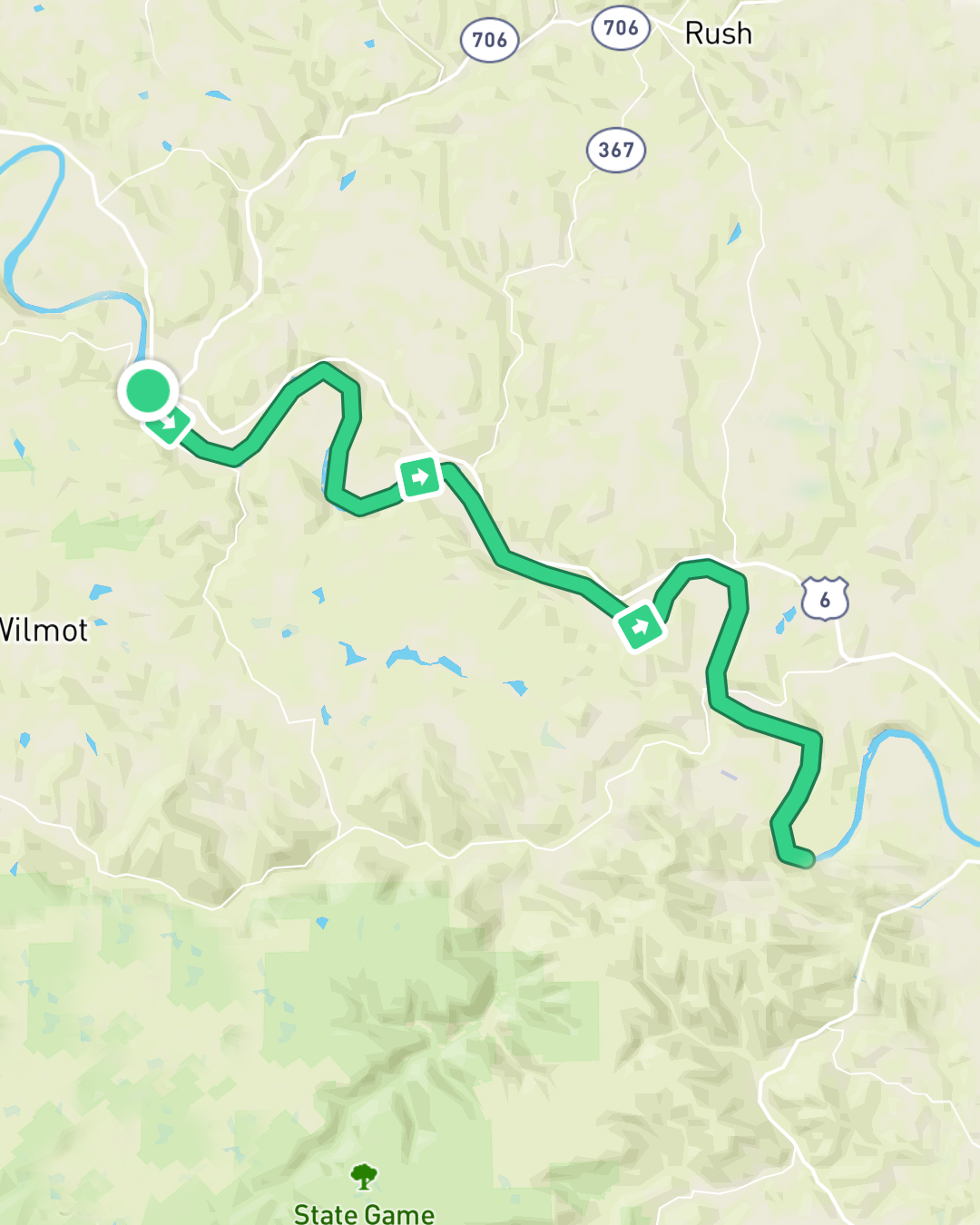
Photo: Joel Witwer
So far on this paddle, we had been blessed with incredible weather – warm nights, cool days, and not a drop of rain. But all good things must come to an end and the forecast had long predicted we’d have rain all throughout day nine. Not relishing the idea of paddling in the rain only to set up camp and sleep in the rain, we decided to make day nine a self care day. We found info on a camp retreat named Camp Lackawanna that also rented out cabins by the night. We called them up and sure enough they had space for us. They were 25 miles from our starting point meaning we’d hit our mileage for the day, but not push ourselves too hard.
With our end destination set, we were off and, sure enough, by 10am the rains started and continued on-and-off for the rest of the day.
By lunchtime, we were in Meshoppen, PA and opted for a warm gas station lunch. We beached the kayaks near a drizzle of a tributary and scaled the steep banks to the gas station. We must’ve been a sight to behold emerging from the weeds disheveled from the rain and reeking to high heaven from not having showered in a week while wearing the same clothes day in and day out. Regardless, the gas station attendant hooked us up with some of the best chili I may have ever had as well as telling us tales of her town. Turns out the gas station supplements its income by pumping water out of the creek for oil companies to use in their fracking. When we asked if there was a tap we could fill out water bottles in, she told us you can’t drink the tap water in Meshoppen. I’m not sure she connected the supplemental fracking income to the lack of drinkable water, but we made a mental note to stop filtering river water and stick to bottled water for a while.
Back in the water, we arrived at Camp Lackawanna in what felt like no time. The camp director actually drove down to the river and gave our wet and stinky selves a lift up to our cabin. It was a simple place with bunk beds, four walls, and a roof, but when I woke up warm and dry in the middle of the night to the sound of cold and wet rain on the roof, the cabin felt like a palace.
Day 10
Tunkhannock, PA – Pittston, PA
29 miles/47 km
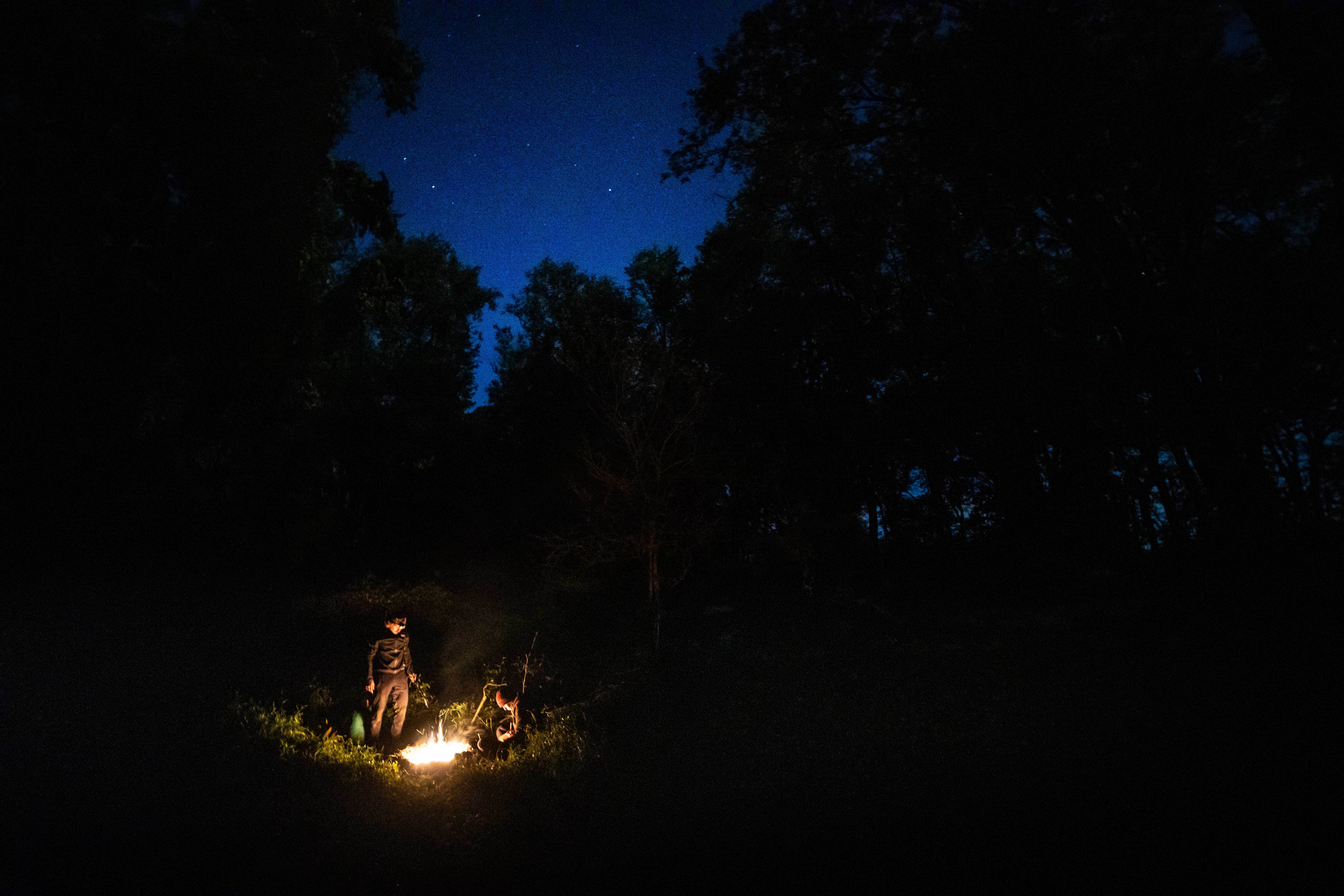
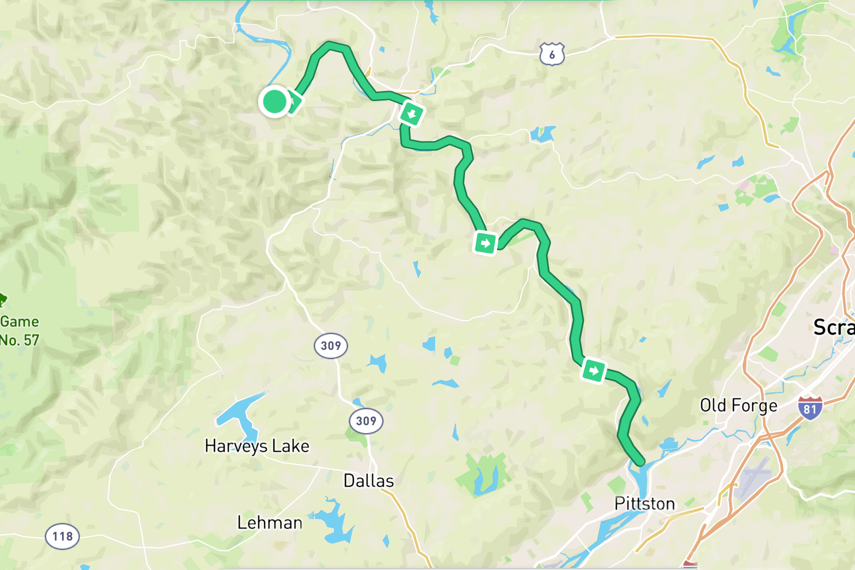
Photo: Joel Witwer
More than just width and depth, it’s been fascinating to see the river change over the course of this journey. We started out with a windy creek, turned into a meandering river with no regards to state lines, and – for the past few days – found ourselves in a joy-inducing river snaking through the Endless Mountains of PA (spoiler alert: they do actually end and day 10 is when we left them behind).
One of the more recent changes in the river was the make-up of the riverbed. It seemed the moment we entered PA for the final time, the river was suddenly was brimming with boulders. Sure there had been big rocks before, but the riverbed had been mostly small rocks that we would scrape in shallow sections. They could be frustrating but were essentially harmless. Now the boulders paired with the extremely low water levels made paddling these sections a nightmare. I’m sure there would still be challenges at higher water levels, but with the hand we had been dealt, the boulders were just barely submerged in the river. They were deep enough to not cause telltale ripples on the river’s surface which would allow us to avoid them. And they were shallow enough for our kayaks to unexpectedly hit them. We’d be paddling along in what felt like deep water and then BAM, we’d find ourselves beached or, even worse, if we hit the boulder at the right angle, the kayak would tip, threatening to capsize us. Thankfully none of us went under in this way, but this section immediately following Tunkhannock was infuriating. Easing the pain though was the knowledge that we had just crossed mile marker 222 (km marker 357) meaning we were halfway done!
We finished day 10 just north of Pittston, PA with the impressive lights of Wilkes-Barre in the distance. Zach ended up finding us an incredible campsite on yet another remote island. We slept in a clearing with a stunning view of the night sky above. A 2500 star hotel. (Fun fact: while there are billions of stars in our galaxy, we can only see about 2500 with our naked eye at any one time – obviously dependent on light pollution, weather conditions, etc)
Day 11
Pittston, PA – Wapwallopen, PA
31 miles/50 km
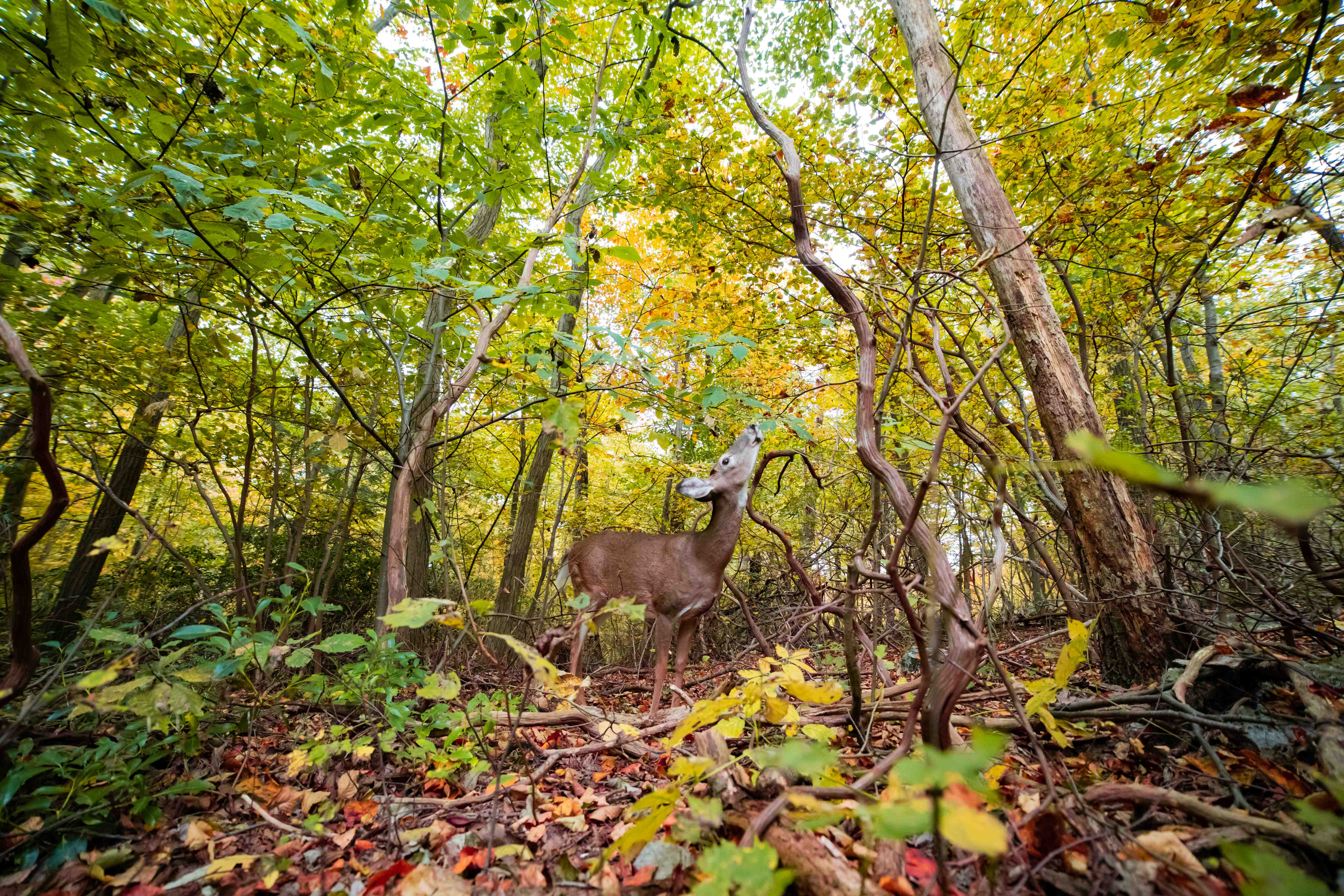
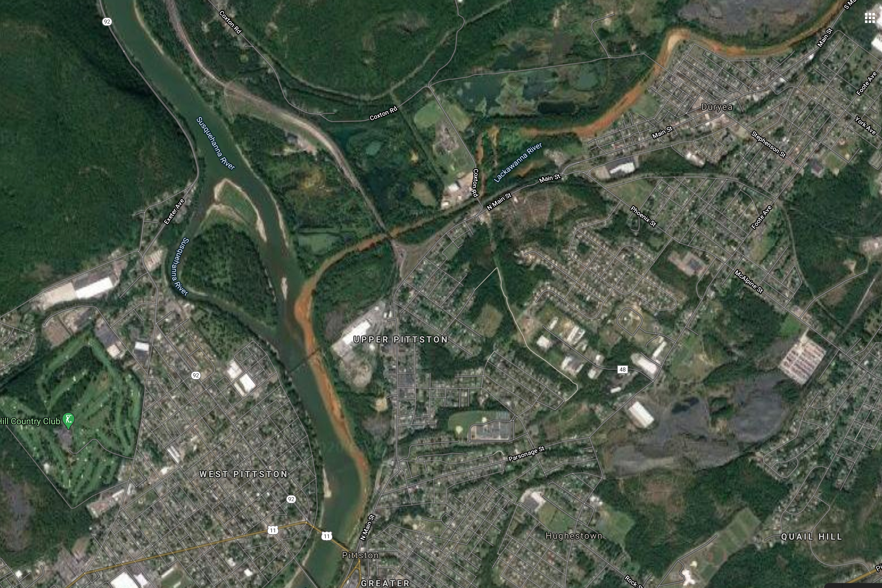
Photo: Joel Witwer
One of the aspects of this trip that constantly amazed me were the intimate experiences we had with wildlife. A few days earlier, we had startled a black bear as we had rounded a bend. We had already been hanging our food in a bear bag at night, but we hung it just a little higher that night. We encountered a fox drinking and we were treated to it running alongside the river. I had seen kingfishers fishing, beavers beaving, and Michelle saw an otter. Over the course of the trip, we saw probably 100+ bald eagles and a rare golden eagle. We learned that deer can swim and that bald eagles scavenge when they don’t feel like fishing (we saw one eating a deer carcass).
But what we hadn’t seen, up until day 11, was the pollution in the river all these animals had to deal with on a daily basis. Sure we heard about fracking and encountered agricultural runoff, but for the most part the water seemed clear and beautiful.
I had started day 11 slightly earlier than Michelle and Zach so I could float and filter water from my kayak as they were still loading up. It was going well, but as I floated downstream and towards river left, the water suddenly became murky and a concerning orange/brown rust color. I stopped filtering as I guessed it probably wasn’t the best to drink it even filtered. What I didn’t know at the time is that just across from where we slept, the Lackawanna River entered the Susquehanna bringing along with it acid drainage from abandoned coal mines upstream. This drainage stained the river for the rest of the day. The water eventually cleared, but, for days to come, every paddle would stir up a cloud of rusty sediment from the riverbed. I’m sure there is a lot more pollution along the river, but this was by far the most visually alarming.
(check out the rust stain on the right side (river left) of the above satellite image)
Day 11 ended in Wapwallopen, PA. One of my Rochester buddies, Adam Bixby, now lives in the area and gave us a warm floor to sleep on and, most importantly, a washing machine to wash the reeking clothes we had been wearing for 11 days.
Day 12
Wapwallopen, PA – Danville, PA
28 miles/45km
Photo: Adam Bixby
After having given us a warm place to sleep, shower, and wash our clothes, Adam decided to join us on our day 12 paddle. Unfortunately for Adam, the first half of day 12 was one of our more challenging days as of late. We battled shallow water reminiscent of our first two days and we had a frustrating headwind.
The water finally deepened as the river narrowed around Berwick allowing us to actually paddle. The next challenge was represented by an ominous red danger diamond on our map. “Nescopeck Falls” is what it read “very hazardous during low river levels.” Adding the frustration, the falls appeared to be directly under a bridge meaning all of our satellite map scouting from the sky was of no use.
We proceeded with caution as we could hear the crashing of water long before we saw anything. Turns out Nescopeck Falls is a small waterfall, maybe a 5ft / 1.5m drop, but with the current being so slow, we were easily able to paddle around it and down a small offshoot of the river. Had we been better kayakers, there’s a chance we could’ve shot the falls. Evidently, at higher water levels, it’s not even a waterfall anymore, just some rapids with a chance of a whirlpool.
By 3pm, we reached Bloomsburg which is where Adam had been arranged to leave us. Our time with him was short, but his hospitality and energy on the river were honestly reinvigorating. The goodbyes had to be quick though since we only had a few hours of daylight left and ten miles left before Danville.
We pulled onto our intended island as night fell only to find it plastered with No Trespassing signs. Our m/o up to this point had been to just find a remote island and sleep there. The plan should anyone ever find us was to be honest and say we didn’t know we couldn’t if there were indeed rules against it. In this case though, it was very clear we weren’t allowed to sleep here. After a brief ethical debate, we looked for another camping island. Thankfully there was another one very close by with no signs (and yes we looked diligently). It was small but more than big enough to play home for the night.
Day 13
Danville, PA – Herndon, PA
24 miles/39 km
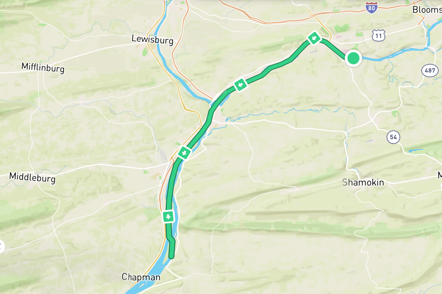
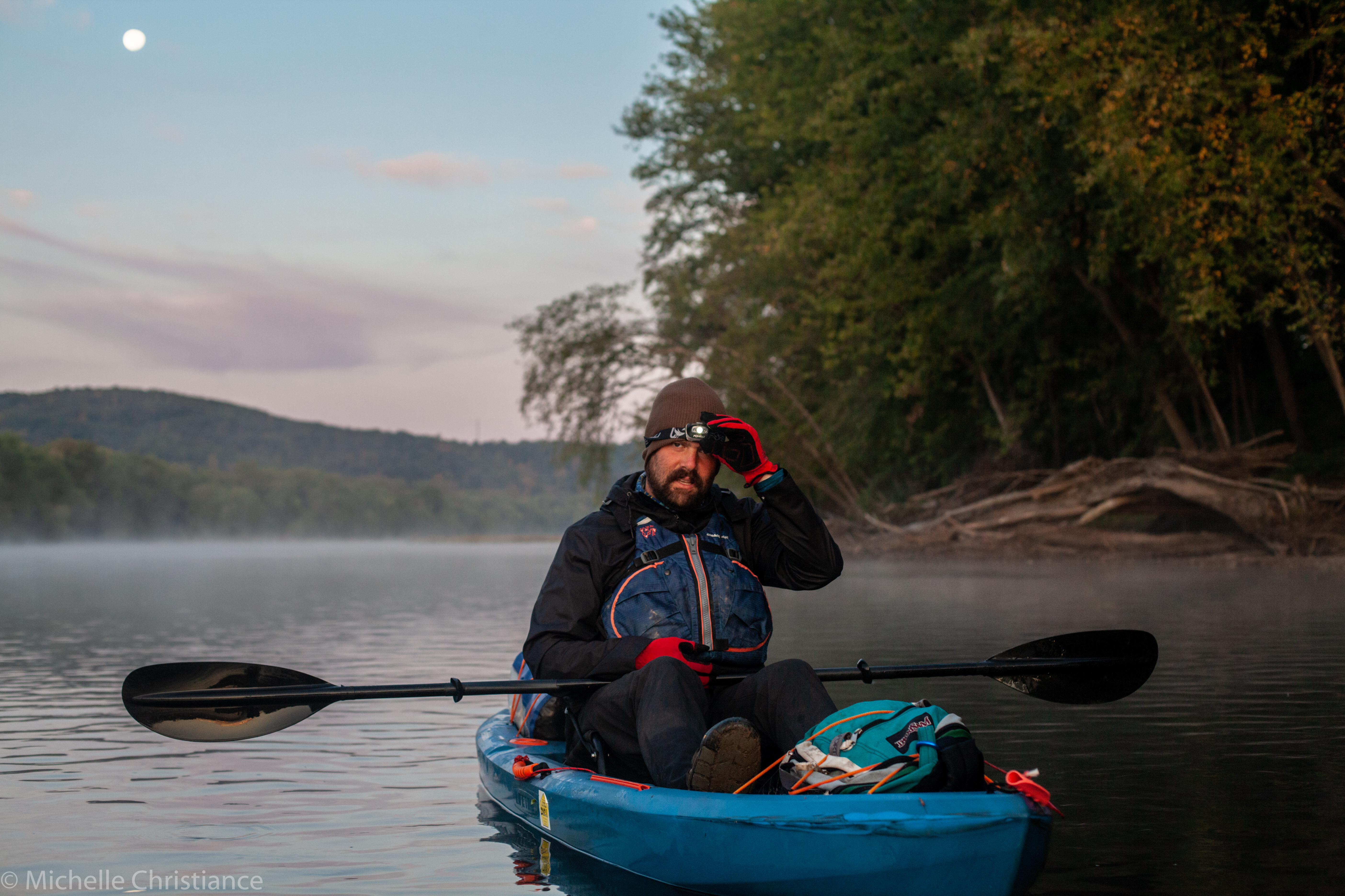
Photo: Michelle Christiance
The big news of day 13 was we finally reached the confluence of the north and west branches of the Susquehanna. Our northern branch had been growing over the course of our trip, but was instantly transformed into a monster of a river, easily a half mile wide (fun fact: the river reaches peak width a few days downstream in southern PA where it’s about 1.5 miles wide). What would have most likely been a choppy union of the two rivers was tamed by the Sunbury Fabridam just south of the confluence.
Now we had been hearing about this “fabridam” for a while now. Every other dam on the river is just referred to as a dam, this one was exclusively called a fabridam. Turns out this dam is made of several balloons, for lack of a better term, that can be inflated or deflated depending on water levels. It’s also supposedly the longest inflatable dam in the world although there are rumors China might be coming for that title …
After the dam, and with two river’s worth of water flowing it, the Susquehanna took on a much different character. The islands grew bigger and we started seeing full on farming fields on islands. One island even had a tractor on it! Where we started, a tractor would have taken up the entire river.
This is one of the reasons I had wanted to paddle the river in the first place. I had only known maybe a 50 mile section of the river for most of my life, but there is so much more to the Susquehanna than the water between Duncannon and Columbia. Each section so far had had it’s own peculiarities, frustrations, and beauty as would the sections to come. And here on day 13, we had that wondrous, and challenging, experience of figuring out how to navigate this new riverscape.
We ended the day in Herndon, PA where Zach’s family thankfully has a small cabin. My parents had driven the hour from their home to Herndon to pick us up, transport us to the cabin, and feed us a warm meal. After two weeks on the river, it was nice to see family again and it helped usher in the familiar feel to the next few days of paddling as we were approaching Zach’s and my hometurf.
Day 14
Herndon, PA – Duncannon, PA
26 miles/42 km
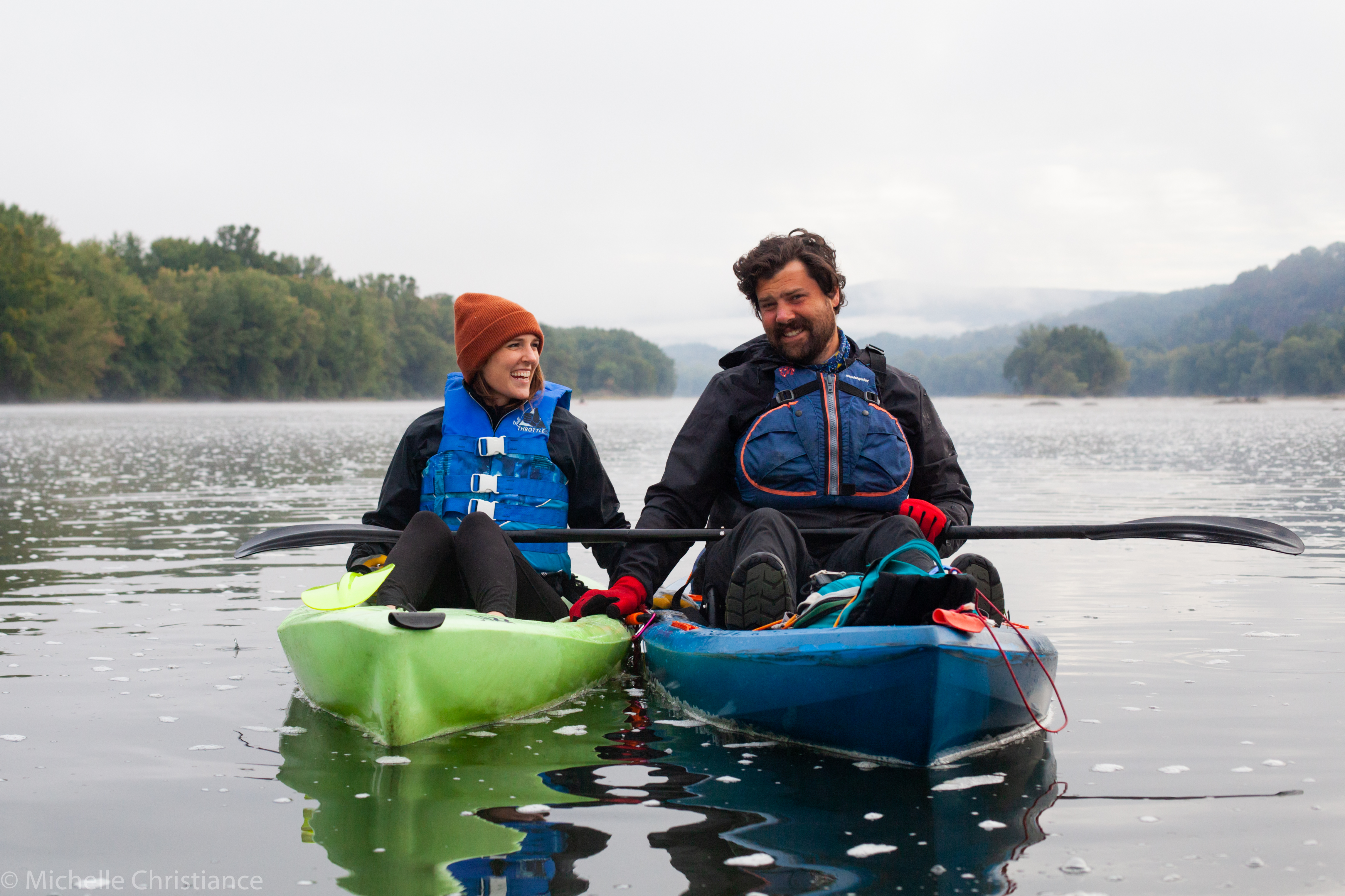
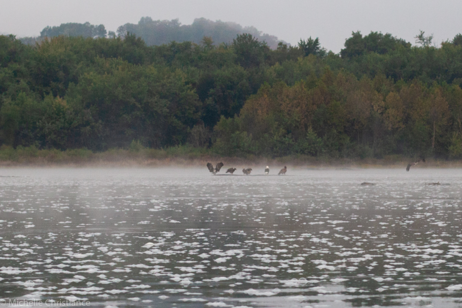
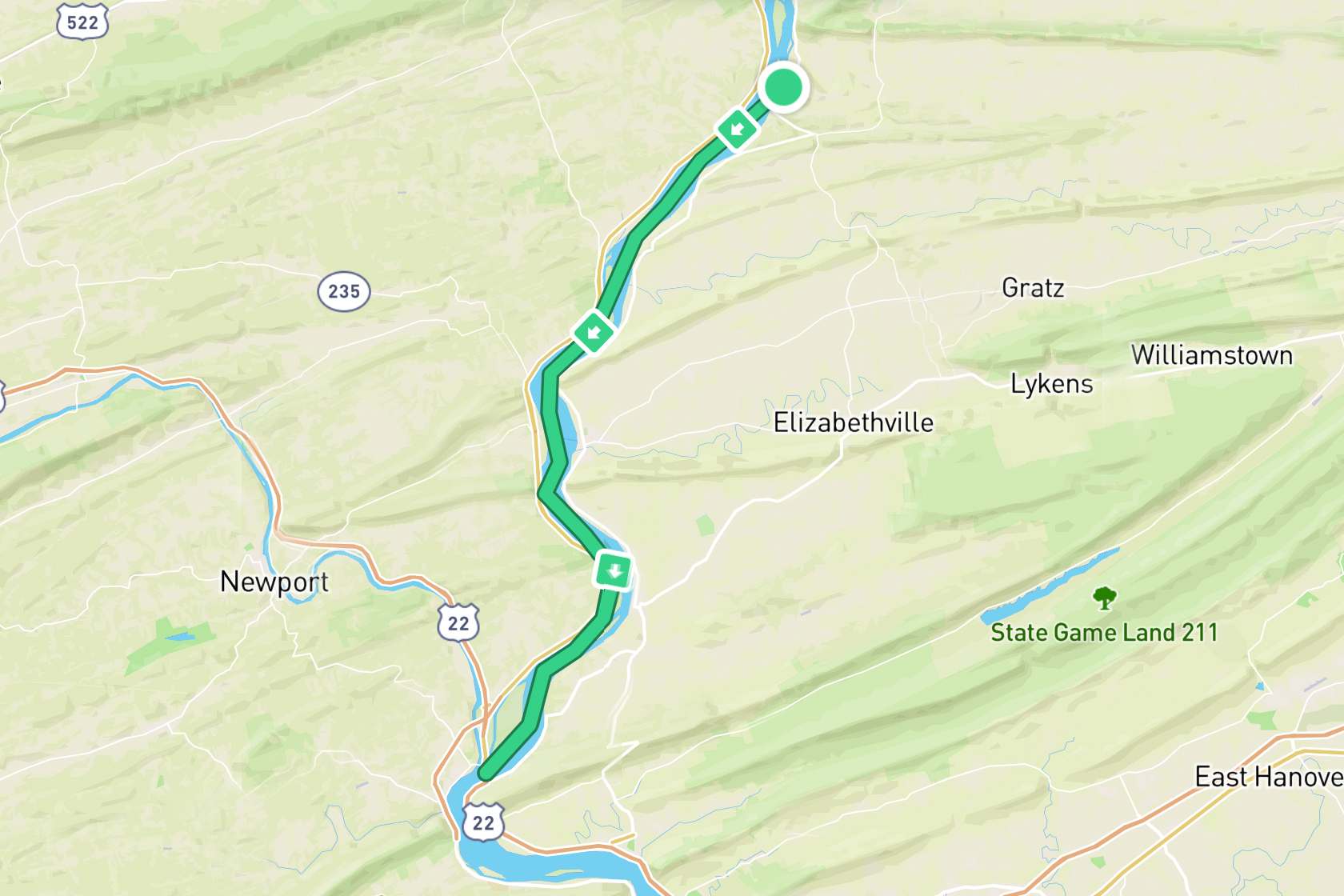
Photo: Michelle Christiance
With a good night’s sleep and full bellies, we set out. This time with my littlest sister Emma. The day started by us being treated to a convocation of bald eagles. Michelle got a photo of five resting on a log, but there was another logfull just off the frame and several in the sky. It was easily the highest concentration of bald eagles we had seen all trip!
By breakfast, we passed a riverside Amish bakery. We got super excited to introduce Michelle to the PA cultural treasures that are whoopie pies. We beached the kayaks, scaled the bank, crossed the highway only to realize it was Sunday and Amish businesses are closed. Defeated, we retreated to the banks for consolation protein bars.
By mid-afternoon we had figured out our plan of attack for this new riverscape. While the river was wide, the middle was un-paddably shallow, but if we stuck to one side, we could find a decent current and good depth. Another peculiarity was that the just-under-the-surface-threaten-to-capsize-you boulders we fought in the Endless Mountains were replaced by just-under-the-surface-threaten-to-capsize-you boulders stone ridges that were equally frustrating. While I hate these ridges just as much as the boulders, it was pretty rad to see this geological shift.
We took lunch in Millersburg and checked out the ferry there which is the last ferry operating across the Susquehanna. Well normally it is. It wasn’t running while we were there as, surprise, the water was too shallow.
We finished the day in Duncannon where we were once again met by my parents, but this time to transport us to their house. Before that though, we had to stop at 3B Ice Cream which Zach had been talking about since we started paddling.
Overall Emma did great! Out of the three guests we had join us, she paddled with us the furthest and got to experience our hate of shallow water, a few fun rapid sections, and the pleasure of a swift current! Selfishly, she was my favorite guest. (I still love you Kasey and Adam!)
Day 15
Duncannon, PA – Middletown, PA
25 miles / 40 km
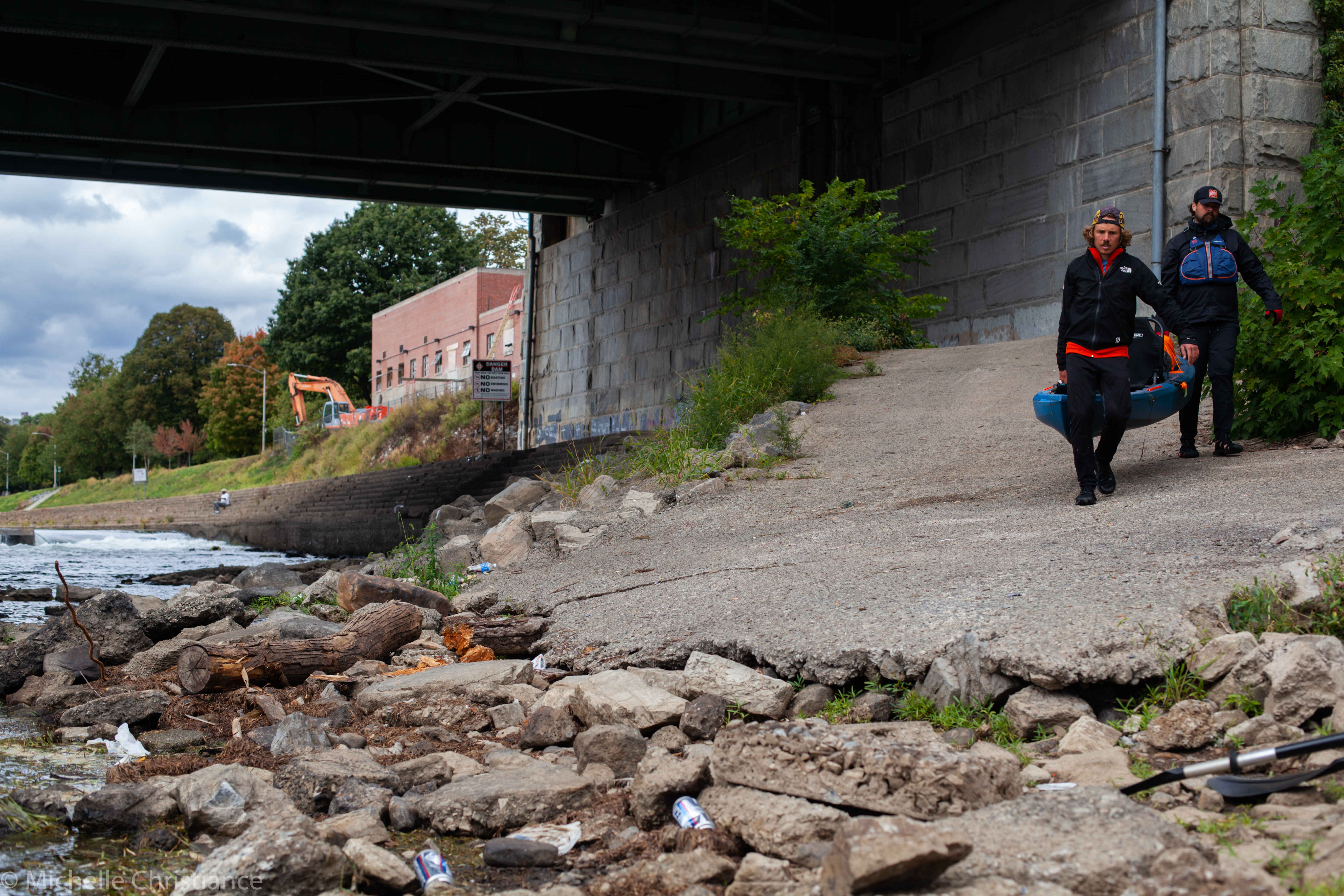
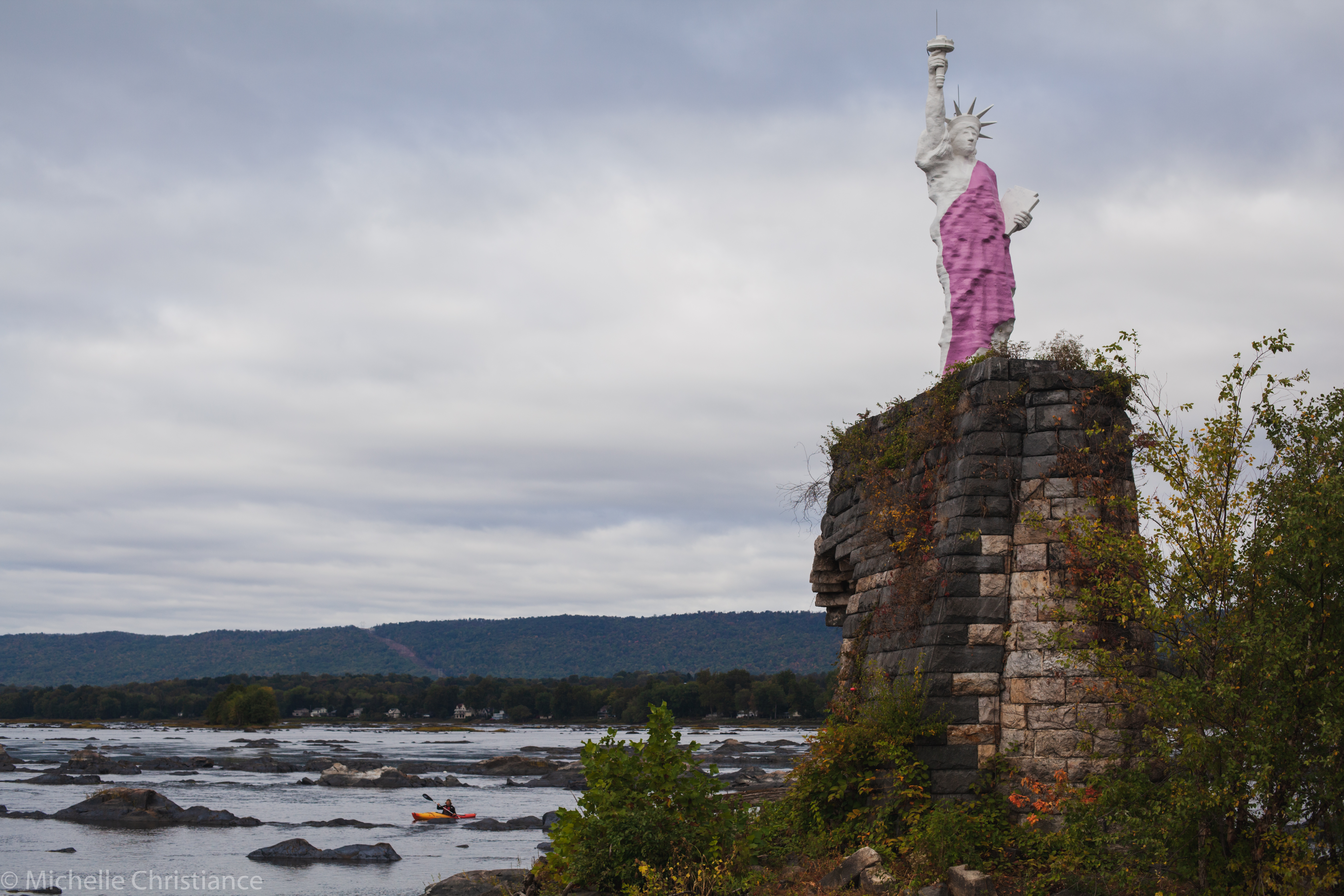
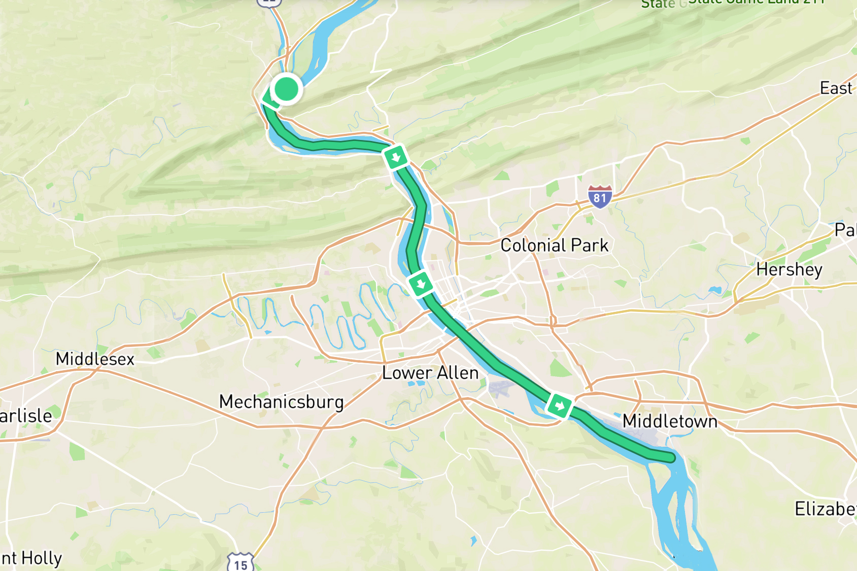
Photo: Michelle Christiance
Day 15 started out in a boulder field that would’ve been rapids at high water levels. It would have been a nightmare to pick through the boulders, but thanks to detailed maps provided free by the local kayak shop, we were able to get through with ease even at the low water levels.
Given how low and slow the river was, we took the opportunity to stop by a Susquehanna legend – Lady Liberty of the Dauphin Narrows. She’s a replica of the Statue of Liberty standing at 35ft / 10.7m and set on an old bridge pilon. She was put up in the middle of the night back in 1986 and caused traffic jams on the riverside highway as people gawked at the mirage. I’d seen her from the shore for years and once tried to get out to her in the middle of the night with no luck. Getting out to her as we paddled by was more than a little exciting for me. I got so pumped as we got close that my eyes were on her and not on the rapids we were navigating. I ended up taking a bad path, capsizing, and losing our maps for the remainder of the trip … It was a literal dampener on the excursion, but it was still cool to finally be there!
Soon after Lady Liberty, we paddled under the Rockville Bridge which is the longest still functioning stone arch bridge in the world. After that it was just a long paddle into Harrisburg. As we approached downtown, I noticed someone on the shore. “That looks like Hannah I thought to myself” and as the thought finished, the figure waved to me and it was indeed my sister who lives just blocks from the river! She and Zach’s friends Matt and ANna joined us for lunch on City Island.
To end the day we just had to portage around Harrisburg’s Dock Street Dam (pictured) and then handle the long, slow paddle past Harrisburg’s two airports. We ended in Middletown where we were once again picked up by my parents and transported to Zach’s parent’s house for more warm dinners and beds. We were definitely getting spoiled here on this last leg of the paddle!
Day 16
Middletown, PA – Washington Boro, PA
24 miles/39 km
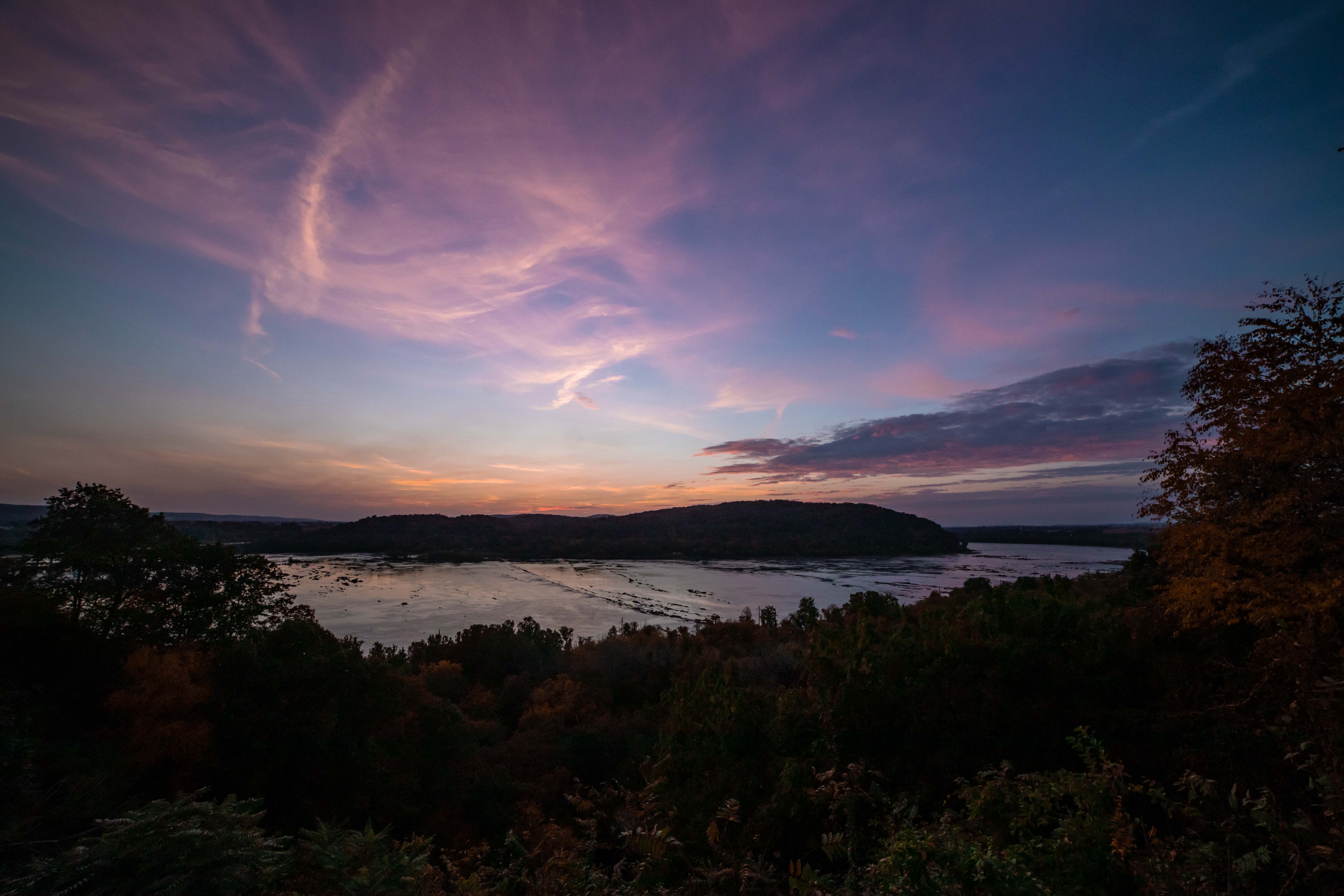
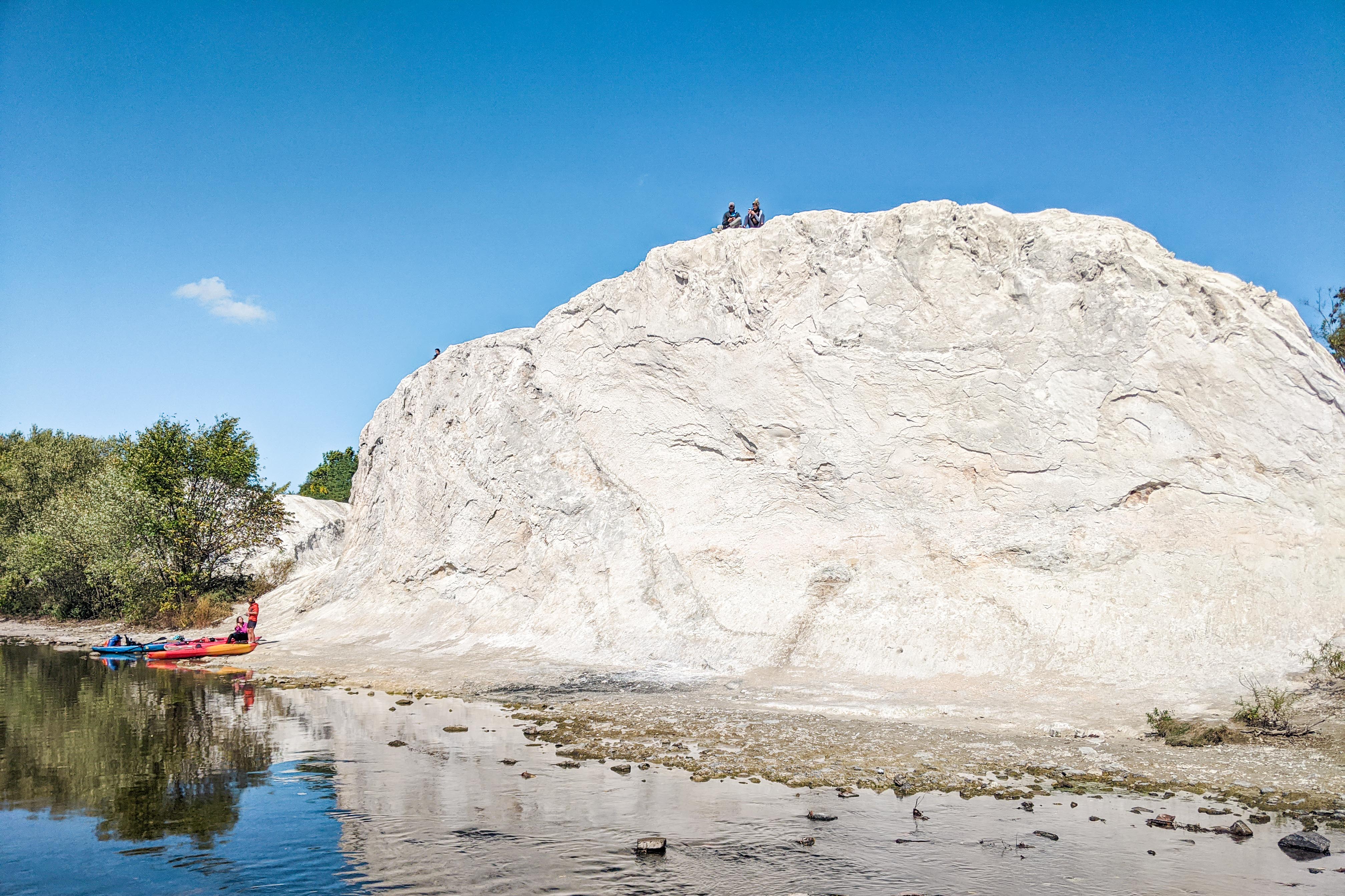
Photo: Joel Witwer
Day 16 started out rather intense. We had the thickest fog of the entire trip. The kind of fog where you can see maybe 30ft/10m but no further. To make things a little more tense was our first obstacle of the morning was to paddle around the retired nuclear power plant Three Mile Island (TMI). The waters around TMI are restricted and there’s a dam if you take the wrong route. Zach did a great job of blindly leading us until I asked him to check his phone map to make sure we were indeed heading to the correct channel. In those few moments where we paused, the kayaks rotated slightly in the meandering current and, unable to see any landmarks, we completely lost our bearings. Michelle and I had also drifted slightly away from Zach and all of the sudden we couldn’t see him anymore. We could hear him, but for the life of us couldn’t figure out how to get to him. So disoriented, Zach had actually started paddling upstream trying to find us. Thankfully modern technology prevailed. I was able to call Zach and we identified a good meeting point. Then Michelle and I paddled on navigating using the little blue location dot on Google Maps to make sure we were heading in the right direction. Soon we found Zach waiting for us. It was honestly one of the more nervous moments of the trip – separated and with the threat of both restricted waters and dams looming.
Even with how soaring the cooling towers of TMI are, we didn’t even see them until late in the morning when they eventually peaked through the top of the fog.
Soon after TMI, we came upon York Haven Dam which turned out to be the longest portage of our paddle at 0.4miles / 0.6km.
We took lunch at the White Cliff of Conoy (photo 2) which have become a popular tourist attraction in the recent years. The funny thing is they aren’t natural. They’re an industrial waste site, formed over decades of a local limestone quarry dumping their waste material on the edge of the river.
Our day ended in Washington Boro boat as it was the last take out spot before the Safe Harbor Dam which we would tackle the next morning.
Day 17
Washington Boro, PA – PA/MD Border
26 miles/42 km
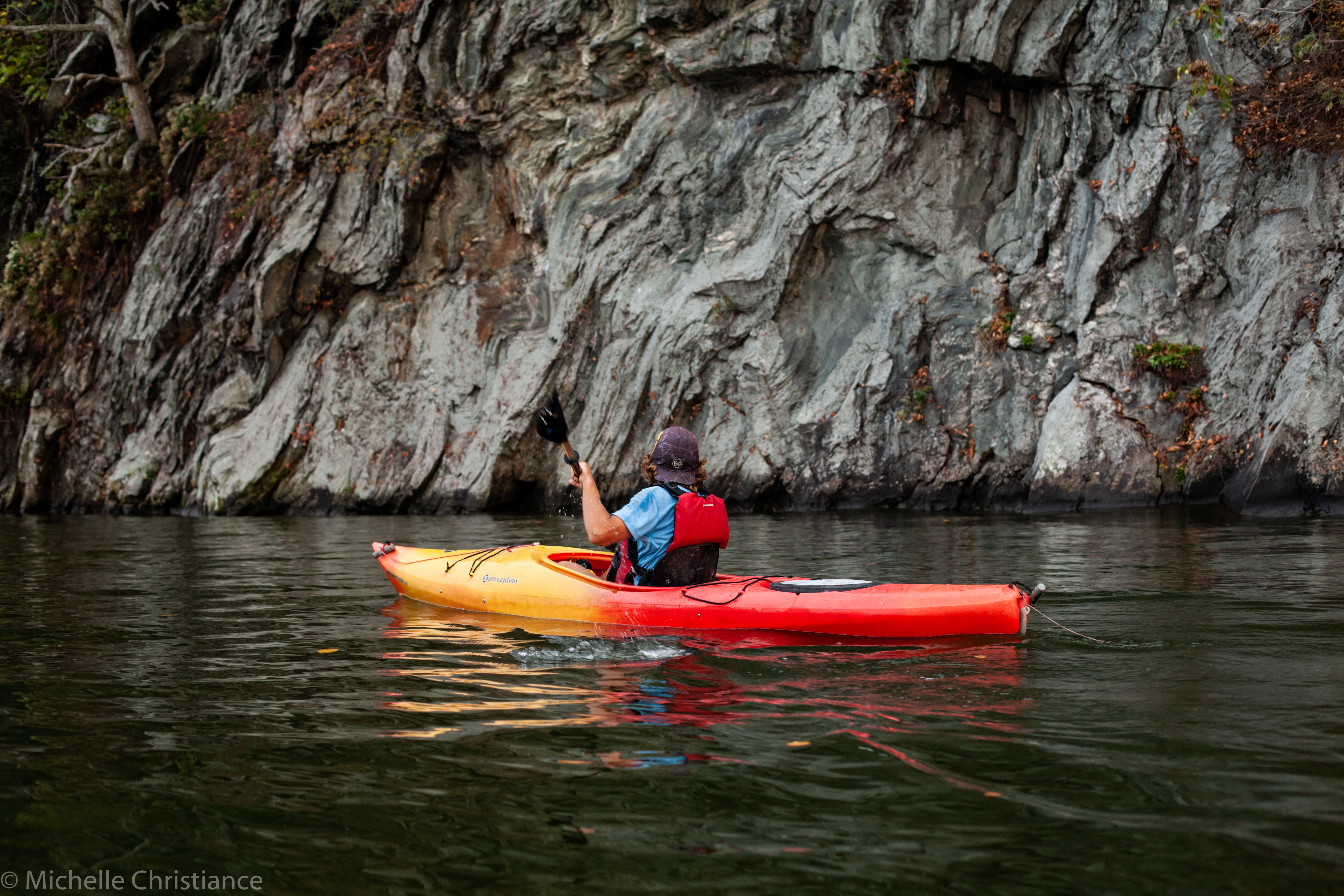

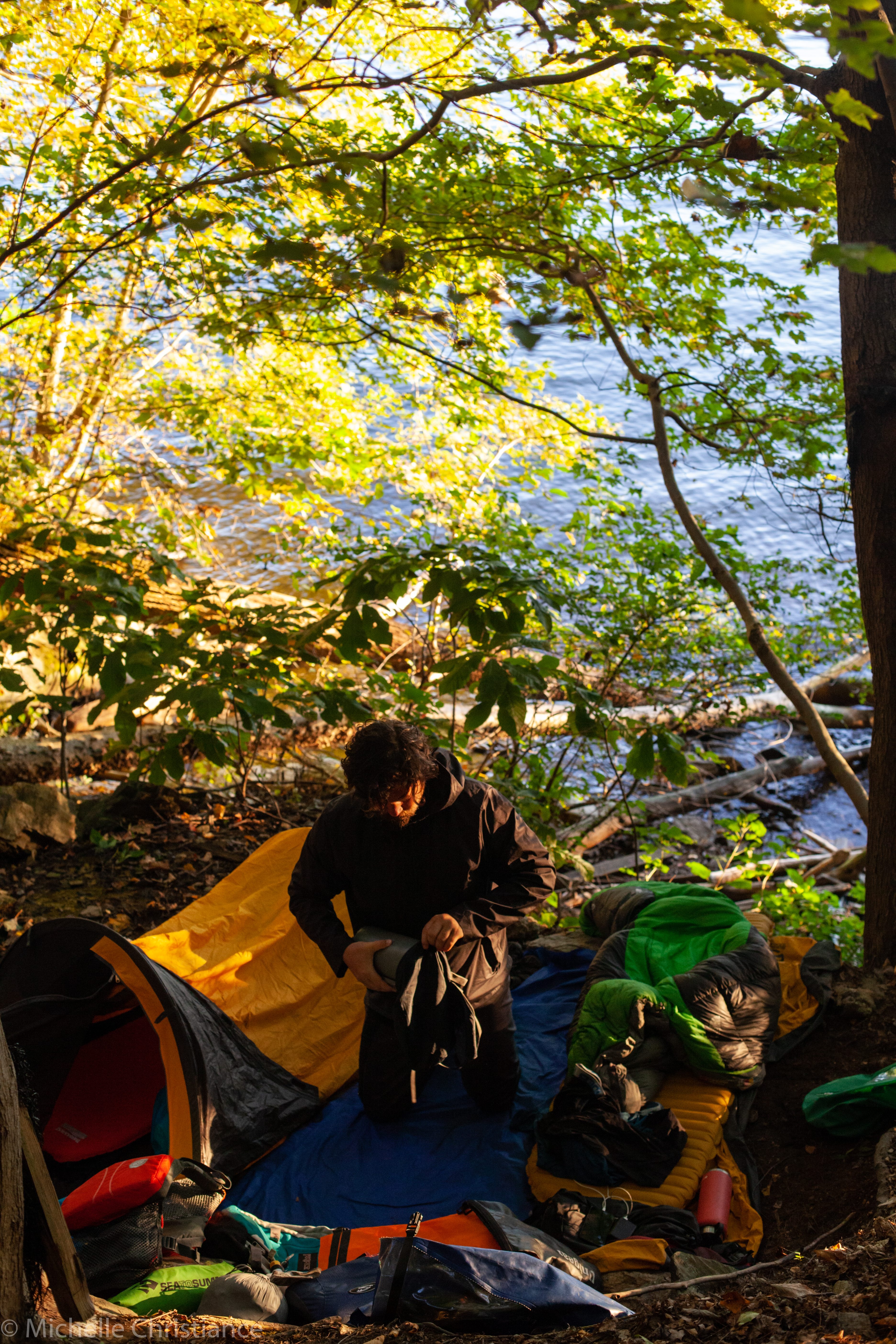
Photo: Michelle Christiance
Unlike most major rivers, the Susquehanna doesn’t have any real commercial traffic on its waters. The sheer number of rapids along with the general shallowness (it’s oft lamented the Susquehanna is a “mile wide and a foot deep”) make the river unfeasible as a commercial route. Because of this, people have had little hesitation to dam it up – first to make sections deep enough for ferries and then to take advantage of it for hydroelectric purposes. Here on this final push to the Chesapeake Bay, we were about to hit the three biggest dams on the river and experience how they completely transformed the riverscape.
As soon as we had passed the Columbia-Wrightsville Bridge yesterday, the water started backing up and slowing down due to the upcoming Safe Harbor Dam. We were still technically on the Susquehanna, but the section we started out Day 17 on is also known as Lake Clarke. It was a slow six mile paddle to Safe Harbor and it was the first of three dams on the river that you’re not allowed to portage yourself around. We had to call ahead and schedule a pick up. We had done so and sure enough, we were met by two maintenance guys who drove us around the dam. Definitely easier than carrying our kayaks around the monstrous structure!
On the southside of the dam, we entered the Lake Aldred section of the Susquehanna which is created by the upcoming Holtwood Dam. We were a little late for our scheduled pick up due to thick water, a rough headwind, and competing information as to where exactly to meet for the portage, but we made it around easily. With Holtwood Dam behind us, we entered Lake Conowingo created by the Conowingo Dam which we would tackle tomorrow and was the last dam before the Chesapeake.
From here, it was just another long and slow paddle to the PA/MD border where we called it for the night. The problem here though was that Conowingo Lake has incredible steep sides which made it hard to find a spot to camp. We eventually found an old hobo camp where someone had created a flat spot and we were all able to squeeze in there for the night.
Day 18
PA/MD Border – Havre de Grace, MD
14 miles/23 km
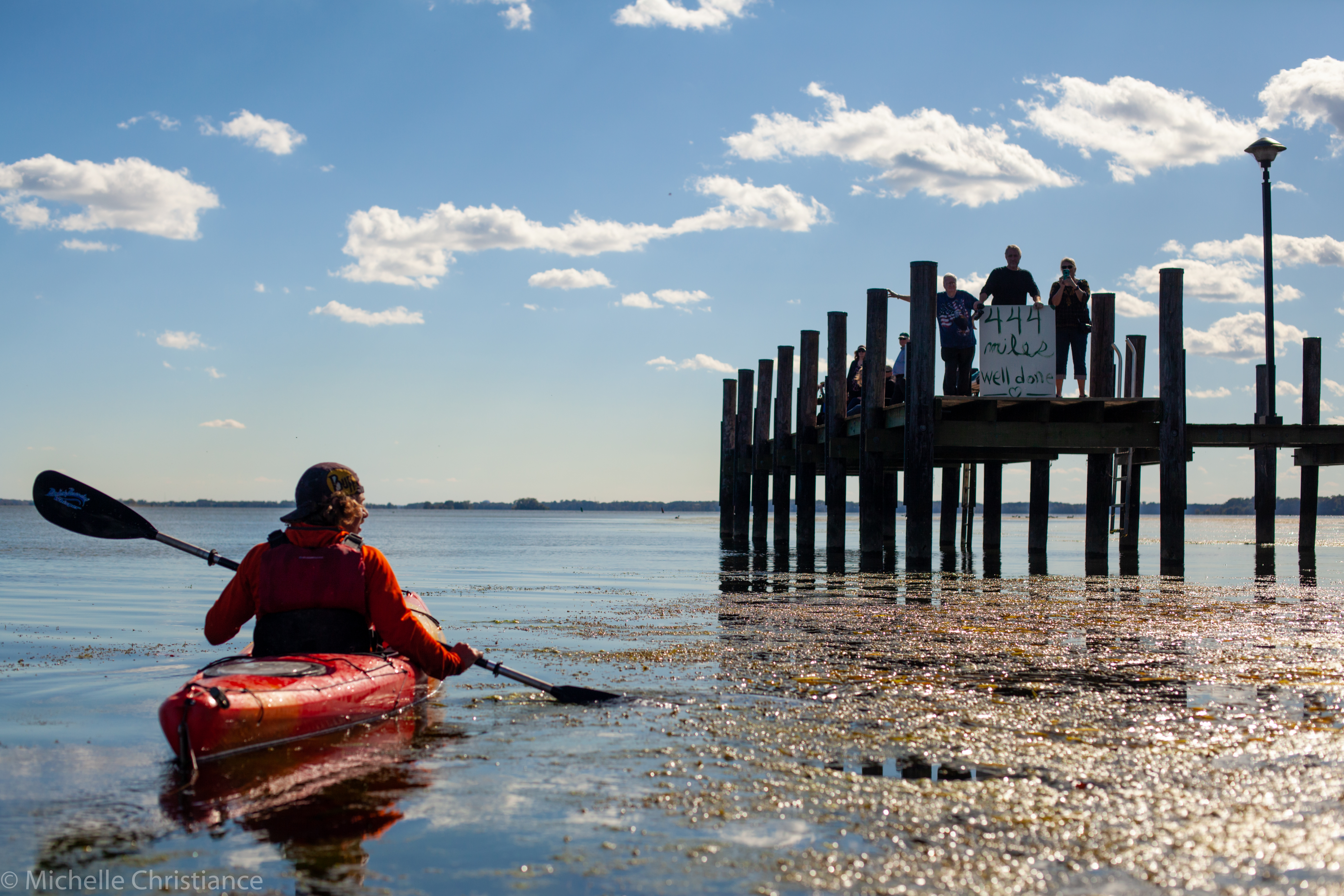
Photo: Michelle Christiance
With just 14miles/23km left to go until the Susquehanna emptied into the Chesapeake Bay, day 18 was a short day. I had read horror stories of gnarly headwinds coming in off the bay and was prepared for the worst. Surprisingly we actually had a strong tailwind pushing us forward. The tailwind mixed with the deep water of Conowingo Lake (max depth 105ft/32m) even created waves crashing in our favor. If you timed your paddles just right, you could almost surf the wave for a little bit. While it was fun, I will take flat water paddling over paddling with waves any day. Yes we kayak surfed a little, but the waves would always pass us and once they did, we’d have to paddle “up” the backside of the wave. Our paddling efforts would oscillate between these fun surfing sessions to the frustrating uphill paddles – back and forth – back a forth. In the end, they opposing forces cancelled each other out and we were still moving at our average speed for the trip.
By 10am we reached our pick up point for the Conowingo Dam portage and were driven around the dam. After the last day and a half of paddling through three thick watered lakes one after another, it was nice to be in the river again and have a small, but enjoyable current pushing us forward.
From the dam, it was a straight shot down the river to Havre de Grace and the end of the Susquehanna river! The tantalizing part of these straightaways is you can see then in the distance, but it’s still miles and hours of paddling away. In the worst moments, it feels like you’re paddling and paddling and never getting closer.
We stopped for a break about five miles from the end and as we set out the others expressed their desire to take things slow and enjoy the last few miles of the trip. Usually, I would be all on board with this expect I was in so much pain that only getting off the river could alleviate. From day 1, I had been wearing my river shoes that had openings on the top of them. They were great for walking through all the shallows, but my feet got sunburned the very first day and just continued to get worse. I would put “waterproof” sunscreen on, but it would almost immediately get washed off in the water. As my skin got more and more burned, the edges of the shoes would irritate the skin and eventually opened up sores that quickly started to get infected. The pain was constant and even standing on them shot lighting bolts through my body. Photo 2 was taken on day 13 when it was kind of funny. By day 18, I was legitimately concerned. Then my fingers were destroyed from being wrapped around a paddle for 10 – 12 hours every day. When I’d wake up in the morning, I’d be unable to close my hands. I’d have to gently massage them until they could weakly hold the paddle again. A few times, in the middle of the night, I’d sleepily stretch and try and close my hand into a fist, making my fingers scream in pain and waking me up faster than a shot of espresso.
With both of these problems, there was nothing I could do about them while still on the river. All that could be done was to finish and rest.
All that to say, is we did indeed finish our thrupaddle by lunch on day 18! We were greeted by my parents with a DIY drywall sign screaming “444 miles well done” to anyone who would read. I had anticipated this moment for so long thinking about the sense of accomplishment or satisfaction I might feel. Now that it was actually happening, all the only emotion I could muster was an exhausted thankfulness that I could finally rest.
Final Reflection
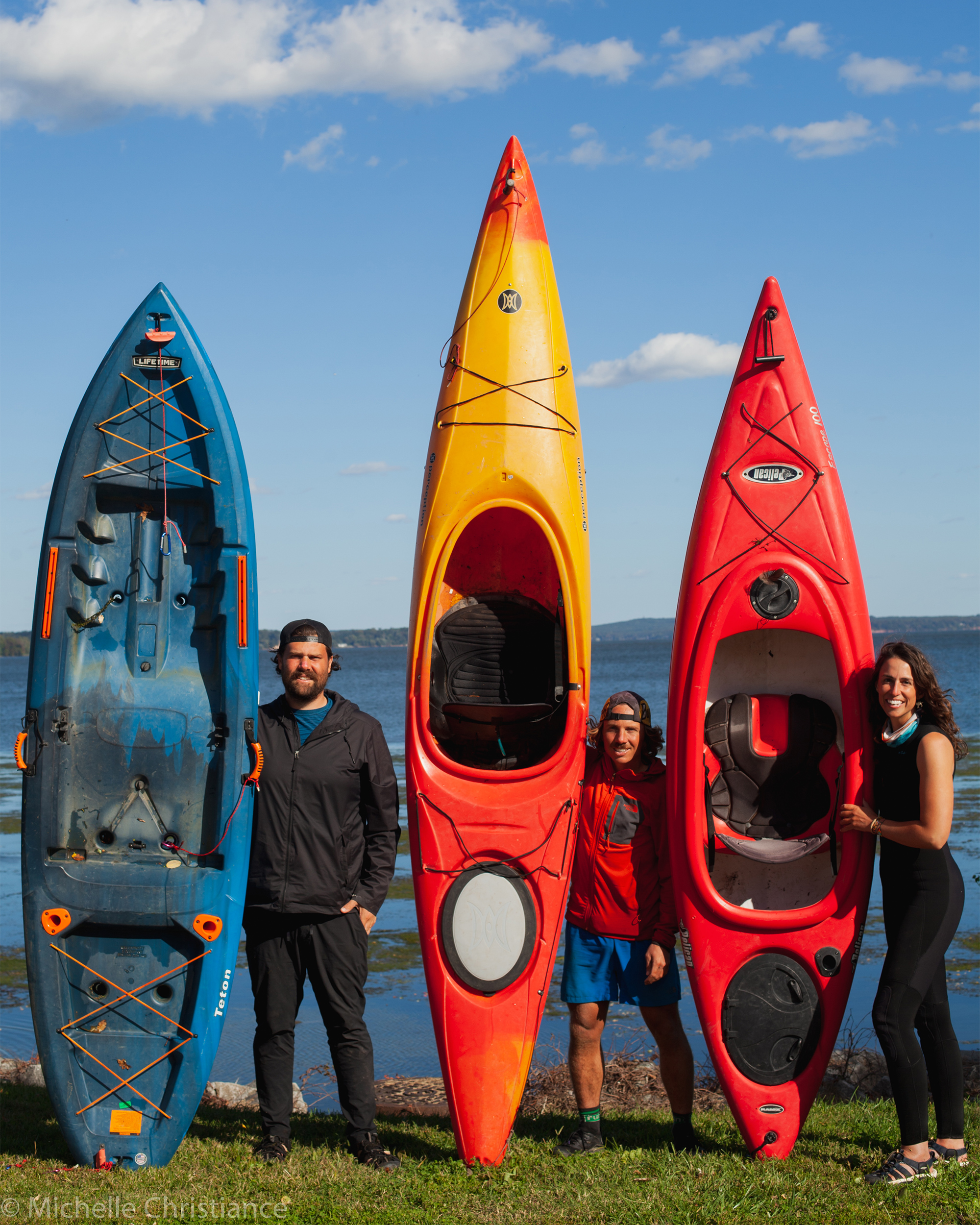
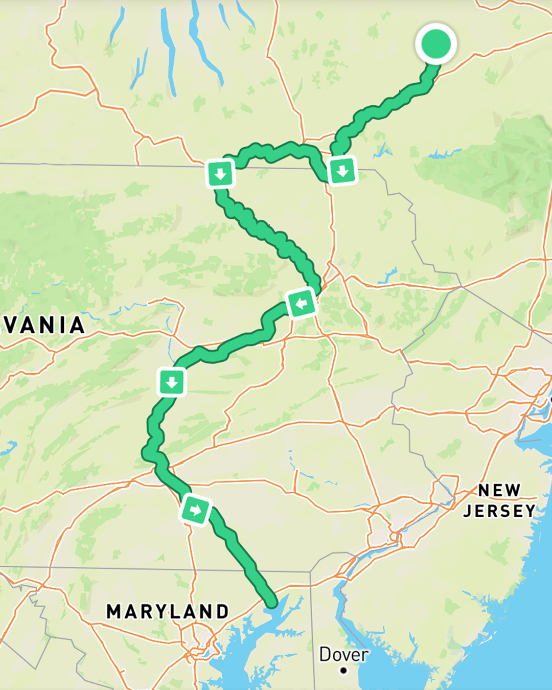
Photo: Michelle Christiance
It’s been just over a month since I completed the river. My feet recovered after a solid week of rest while my fingers still have some residual stiffness which I expect to fully disappear soon. This has been the most challenging adventure I have taken in my 31 years – in terms of physical difficulty, emotional strain, length, duration – everything.
A small part of me had been expecting some instantaneous and grand revelation about life, God, or myself as I pulled my kayak ashore that final time, but no such moment happened. The week after finishing the river, I was kept in a perpetual state of thinking I should process what had happened in order to find those inspirational lessons, but I was too exhausted to even consider it.
My body and mind have (mostly) recovered and I’ve now put in the work to process the instantaneous moments and overarching themes of the trip. Thing is, there haven’t been any life shattering revelations. My life now looks very much the same as it did before the trip albeit with a few odd tan lines. I still wake up, put on my trousers one leg at a time, go to work, and come home.
Adventures absolutely do have the power to completely upend our lives, but sometimes they’re just about getting you out of your comfort zone and seeing how you relate to the world outside your little bubble. I grandly underestimated this adventure before we set off and it pushed me further than I thought I could go. It put us in scenarios we’d never have to deal with in our regular lives and forced us to make decisions whether we wanted to or not. We’ll probably never use whatever kayaking skills we learned on the river in any real capacity, but the practice in problem solving and determination will come in useful again and again.
This long paddle also gave me personally a deeper appreciation and understanding of a river I’d long known, but never gotten to know. There were times I cursed it and times it gave me the biggest smiles. While I’m not rushing to thrupaddle again any time soon, I am indeed grateful for the all the moments it allowed us to spend on it.
At the very least, it’ll all be a good story for the grandkids one day.